A Tail at Three Sites

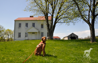
Tavish at Best Farm, Monocacy National Battlefield

Tavish at Best Farm, Monocacy National Battlefield

Many are the lessons that can be learned from historical sites, and a visit to Maryland’s Monocacy National Battlefield a few weeks ago was no exception. For Tavish the Intrepid Pup, the teachable moment came from a “stimulating” encounter snuffling the grass around a low-voltage electric fence by the cow pasture at the Worthington Farm site. (Note: no worries, he’s fine…just a lot more observant now when it comes to fences.) For Team Tavish, it was the realization that were it not for what happened at Monocacy back on July 9, 1864, the Civil War might have taken a different turn.

The battle at Monocacy represented the third and final Confederate invasion of the North. It often doesn’t get its due in history books because of the more epic scale of the previous two invasions at Antietam (1862) and Gettysburg (1863). But Monocacy is intriguing in its own right. With great irony, it was the Union army loss of the battle that actually saved the nation’s capital a mere 47 miles away. There are far greater chroniclers of Civil War battle strategy than the Intrepid Pup, but the basic storyline of Monocacy is this:  Ulysses S. Grant was beginning to successfully deter Robert E. Lee’s Confederate forces in the east. To sustain the pressure on those forces, Lt. General Grant was diverting to Richmond fresh reinforcements in the form of seasoned troops from the various forts that protected Washington, D.C. With relatively few soldiers left behind to “mind the store” so to speak, Lee recognized an opportunity and tasked Lt. General Jubal Early (1816-1894) with making a relatively quick run north up the Blue Ridge to cross at Harper’s Ferry and then invade the capital from the northwest. Early and his men very nearly succeeded except for  intervention from an unlikely source: John Garrett. Personally, Garrett was a Confederate sympathizer. Professionally, however, Garrett was the president of the Baltimore and Ohio (B&O) Railroad with many of his clients and much of his business centered in Union territory. It was he who alerted Major General Lew Wallace, stationed in Baltimore, to Early’s troop movements. Wallace had precious little time to react and even fewer resources to muster, but with an inexperienced band of 2,800 short-term recruits (i.e. not battle trained), he set out to intercede Early. The good news for Wallace was that by the time he encountered Early’s Confederate forces at Monocacy on July 9, his Union ranks had swelled to 5,800. The bad news for Wallace was that he was still outnumbered three to one. Imagine going into battle with full knowledge that the odds are squarely not in your favor.

The battle played out over about 12 hours amid several farmers’ fields and along a rail bed and the banks of the Monocacy River…you can still “read” the battle in the landscape today. By almost any measure, Wallace had been defeated and had lost nearly a quarter of his men in the process. Yet Early hadn’t expected to meet such resistance at Monocacy, and the fighting cost him some 900 men and critical hours. With no choice but to encamp on the battlefield the night of July 9, Early had effectively lost a day—and the element of surprise—in an already tight timeline. Early’s men pushed onward the next morning and reached the northwest boundary of Washington by the following afternoon to mount an attack on Fort Stevens. The delay, however, had given Grant just enough time to send steamships full of soldiers to repopulate the defensive forts around Washington. So, while the fighting at Fort Stevens on July 11 was fierce and deadly, it was not enough to fully infiltrate the nation’s capital. Early withdrew, ultimately unsuccessful in his mission.

Tavish at Fort Stevens

Tavish at Fort Stevens. President Abraham Lincoln went to witness the fighting here on July 11, 1864. Confederate sharpshooters aimed for him, making Lincoln the only U.S. President to come under direct enemy fire in time of war.
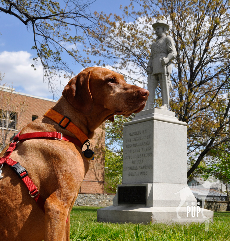
Tavish at Battleground National Cemetery

Tavish at Battleground National Cemetery

Fifty nine Union soldiers lost their lives in the Battle of Fort Stevens—the only Civil War battle to be waged in the District of Columbia—and 41 were buried the evening of July 12 at a site a half mile north of the fort on the battleground itself. President Lincoln attended the interment ceremony and consecrated the land as hallowed ground. Now known as Battleground National Cemetery, this tiny plot of land on Georgia Avenue, N.W. between Van Buren Street and Whittier Place is among America’s smallest national cemeteries. Added over the years were various monuments commemorating the regiments that fought, as well as several plaques bearing such sentiments as: “The muffled drums’ sad roll has beat the soldier’s last tattoo. No more on life’s parade shall meet that brave and fallen few.” There’s also a stone superintendent’s house designed by General Montgomery Meigs (1816-1892), a veteran of the Battle of Fort Stevens and also the architect/engineer of DC’s Pension Building that today houses the National Building Museum.

And what ever happened to Major General Wallace (1827-1905)? Yes, he lost the battle but survived the war and, interestingly enough, went on to write the famous novel Ben-Hur: A Life of the Christ (1880). His book was subsequently adapted for the silver screen several times, with the most notable version being the 1959 film classic (starring Charlton Heston and his famous chariot race scene) that reaped 11 Academy Awards.

Dogging the Details
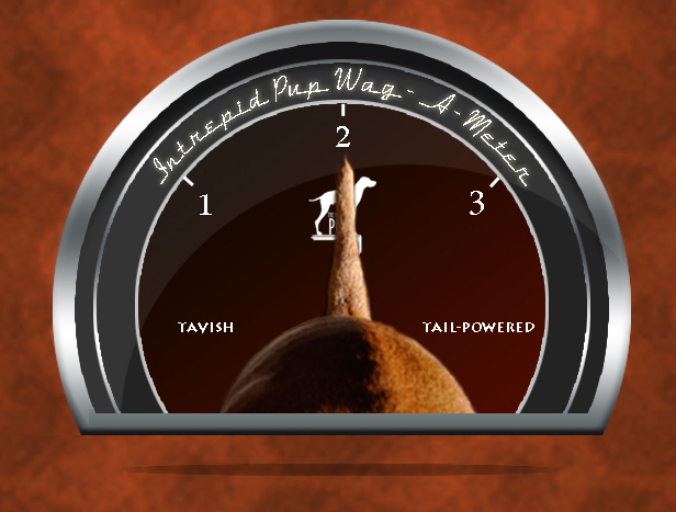
Click to see what 2 on the Wag-A-Meter means39°22′37.90″N, 77°23′43.34″W
Monocacy National Battlefield
, Frederick, Maryland

38°57′52.05″N, 77°1′44.67″W
Fort  Stevens, Washington, DC

38°58′14.69″N, 77° 1′37.23″W
Battleground National Cemetery, Washington, DC
Monocacy NB

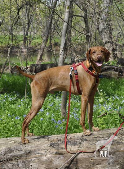
Tavish among the bluebells on the Ford Loop Trail, Monocacy National Battlefield

Because of the three sites’ relatively close proximity to one another, tracing the full story of Monocacy—from the initial battle in Frederick, Maryland, to the conclusion at the tiny cemetery in Washington—is easy to experience in one very full day or over the course of two  leisurely days. There’s the most ground to cover at Monocacy National Battlefield. Begin your foray at the visitors’ center on Urbana Pike. It used to be in smaller quarters at the Gambrill Mill site but moved to this nice new building about five years ago. Although dogs aren’t allowed inside the visitor center, make sure you head upstairs. There’s a succinct yet exceptionally comprehensive exhibition with an overhead timeline, lighted battle map, and several interactives that really help put what you’re about to see outside in a broader context. Be sure to pick up a brochure from the ranger, because it contains not only driving directions but also a trail map. There are 5 separate locations within the national park to get out explore with your dog. As always, dogs are to be leashed and picked up after:

  • While Best Farm and Monocacy Junction don’t have any trailheads per se, there’s plenty of room to explore the immediate vicinities from the parking areas. Best Farm is also associated with a remarkable 1862 event related to Antietam (Learn more at the visitors’ center or Google “Lee’s Lost Orders”!).
  • During the battle, the Gambrill Mill site was co-opted as a Union field hospital, and the short loop trail here includes a boardwalk section leading to the Monocacy River. Tavish enjoyed wading in the shallows.
  • The Thomas Farm site contains two loop trails that wind through the farm fields that withstood the heaviest fighting that day in 1864.
  • Worthington Farm has the longest trails, though neither of the two loops takes more than a half hour to hike. We went on a Sunday afternoon and had the place mostly to ourselves save for a couple joggers. The Ford Loop Trail is flat and hugs the flood plain of the Monocacy River. Should you happen to time it right in the springtime, as we did by happy coincidence, you’ll find the path to be spectacularly carpeted with Virginia bluebells (see photo). Much of the Brooks Hill Loop Trail borders the aforementioned cow pasture. Fresh from his fence episode, Tavish curiously appraised the gangly calves and their moms from a respectful distance. Once the trail enters woodland it quickly gains elevation, topping out on a ridge with an expansive view across emerald farmland toward Thomas Farm.

Back in the District of Columbia, visiting Fort Stevens simply involves snagging a parking spot on the street or in the neighboring church parking lot. All that remains of the once extensive Civil War Defenses of Washington are more than 20 locations throughout DC-MD-VA ranging from simple forest sites to earthworks to full-fledged forts. Fort Stevens is not staffed but does have a couple interpretive panels to orient visitors to the partial reconstruction. Continue the short distance to conclude your journey by parallel parking on Georgia Avenue in front of Battleground National Cemetery.

“Knowledge is the Prime Need of the Hour”: Women’s History Month and Mary McLeod Bethune


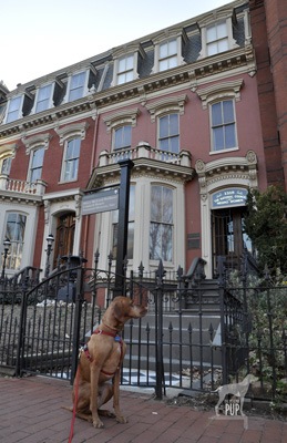
Mary McLeod Bethune Council House

Every March the United States officially observes Women’s History Month—an outgrowth of both  International Women’s Day and, in 1981, a congressional resolution for a “Women’s History Week.”  In recent years the month has been ascribed a theme, with March 2012’s being “Women’s Education – Women’s Empowerment.”

One who personified this theme through her own works was Mary McLeod Bethune (1875 – 1955), daughter of former slaves, educator, key political influencer, and founder of the National Council of Negro Women (NCNW) in 1935. The Intrepid Pup recently visited two sites, both in the nation’s capital under the aegis of the National Park Service, to learn more.

The Mary McLeod Bethune Council House is tucked within a row of stately townhomes in a residential section of northwest Washington off Logan Circle. For the price of $15,500 in 1943, the property became not only Bethune’s residence but also the official headquarters for the NCNW. The site has been administered by the Park Service since 1994. On the day of our visit, we were welcomed by a college undergraduate serving in the Park Service’s Student Career Experience Program. She invited us first to listen to a recording of Bethune speaking at an event in 1955 just a few months prior to her death. Hearing Bethune’s actual voice was a good introduction to someone we previously knew very little about, and it gave us the impression of a strong yet humble woman with a commanding presence. The ranger gave a brief orientation on the highlights of the home’s history, encouraging us to explore the rooms and interpretive displays on the first two floors. She checked on us several times to answer our questions. We had the house to ourselves that weekend afternoon. Just beyond the reach of the tour bus throngs on the National Mall, this historic site is not a high-traffic destination. Yet contributing to its appeal is the very fact that in providing a personal, intimate experience it is in marked contrast with its crowded counterparts. Our knowledge and appreciation of Bethune expanded exponentially as we uncovered details about her upbringing in poverty and perseverance in starting Florida’s Daytona Educational and Industrial Training School for Negro Girls (now Bethune-Cookman University)  in 1904 fueled only by desire and $1.50. It seems fitting that today the university offers a master’s degree program in transformative leadership. It was also fascinating to learn of Bethune’s role in championing African American women’s involvement in the war effort and of her official capacities in the Franklin D. Roosevelt and Harry S. Truman administrations.

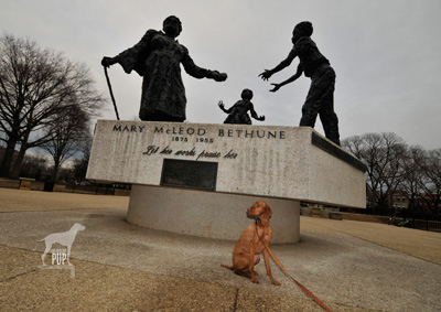
Mary McLeod Bethune memorial in Lincoln Park

About a mile and half away from the Council House as the crow flies is Bethune in monumental form. Sculpted in bronze by New York artist Robert Berks (1922-2011), the statue grouping emphasizes Bethune as educator, literally and figuratively imparting her legacies to a boy and girl. Around the base are inscribed excerpts from her last will and testament which Bethune also holds in her outstretched left hand. The oft-repeated refrain “I leave you…” is completed by such powerful concepts as “hope”, “a thirst for education,” and “racial dignity.” The monument itself has an interesting history. It’s located in Lincoln Park 11 blocks due east of the U. S. Capitol Building. Book-ending the rectangular plot of open space maintained by the Park Service are the Bethune memorial and, sited directly opposite, the famous Freedmen’s Memorial Monument to Abraham Lincoln (also known as the “Emancipation Grouping”) which was paid for entirely by freed slaves and sculpted by Thomas Ball in 1875.  The original intent had been for the dedication of a Bethune memorial to coincide with the 100th anniversary of Lincoln’s Emancipation Proclamation in 1963, but the entire project was delayed. With funding from the NCNW, the Bethune monument was ultimately unveiled in 1974 on what would have been Bethune’s 99th birthday. Adding the Bethune memorial to the park also resulted in turning the Freedman’s Memorial 180 degrees so the two groupings would face each other.

If the Bethune memorial’s roughly faceted, somewhat abstract style looks familiar, it’s because Robert Berks sculpted several high-profile pieces. In DC alone, one can most readily see other examples of his handiwork in the 22-foot seated Albert Einstein memorial (1979) outside the National Academy of Sciences and in the 8-foot, 3000-pound bronze bust of John F. Kennedy (1971) gracing the Grand Foyer of The John F. Kennedy Center for the Performing Arts. In a city dotted with literally hundreds of statues, monuments, and memorials, Berks’ Bethune sculpture represented the first honoring a woman (let alone an African American woman) installed on public park land in the nation’s capital.

Dogging the Details

38°54′29.31″N,  77° 1′50.29″W
Mary McLeod Bethune Council House, Washington, DC

38°53′23.19″N,  76°59′21.13″W
Mary McLeod Bethune Memorial, Lincoln Park, Washington, DC

wag-a-meter set at 2There is no fee charged to explore the Bethune Council House. While dogs understandably aren’t allowed inside, the neighborhood itself has sidewalks and is great for dog-walking.

Lincoln Park is exceptionally dog-friendly and what earns this Bethune-themed expedition a “2” on the Wag-a-meter.  In fact, the park’s entire center concourse is basically one big unfenced and very popular dog run. So long as your dog plays well with others, it’s among the top spots to rub noses with the canine denizens of Capitol Hill. During our visit,  Tavish encountered 3 weimaraners, a doberman, a rottweiler, a basset hound, a Wheaton terrier, a miniature greyhound, a Boston terrier, and a shepherd mix.

Important to note is that Lincoln Park is not an officially-designated city dog park. There are trash cans, but bring your own your poly bags to clean up after your dog.

Getting Out and About in Vacationland

Just learned about the inaugural Great Maine Outdoor Weekend taking place this March 2-4, 2012. It’s being touted as a bi-annual celebration with a “series of events scheduled all across the great state of Maine to help connect [people] with the natural world, and promote fun, physical activity, and good health.”

Well, if that isn’t something that appeals to the Intrepid Pup’s sensibilities, we don’t know what will! Tavish isn’t in Maine this weekend to help celebrate, but he did spend the first 5½ years of his life in “Vacationland” living the state’s motto “Maine: The Way Life Should Be.” And in that time, he had ample opportunity to sample and enjoy some of the best trails, views and natural beauty the state has to offer. So, while this is by no means a comprehensive list, here are some of the Intrepid Pup’s top picks, by region, for getting out and about with your dog in Vacationland:

Dogging the Details

wag-a-meter set at 2

The three excursions described below all rank “2” on the Wag-a-meter as these are active, outdoor adventures with some pre-planning required. You’ll also be out-and-about pretty much the whole day with your dog, so be sure to pack along food/treats, water, and doggie bags.


MAINE BEACHES

43°20′51.32″ N, 70°28′50.92″ W
Kennebunk Beach, Kennebunk, Maine

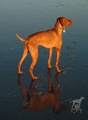
Kennebunk BeachIf you’ve always associated Maine with craggy shorelines, there are plenty. But you might be surprised to learn that beautiful sandy beaches can be found in coastal towns throughout southern Maine. One favorite is Kennebunk Beach. At low tide, this crescent-shaped swath of sand extends out about a hundred yards before receding into the Atlantic Ocean. Then, if you could even see this far, the next land you’d spot would be Portugal. Seriously. The surrounding communities, collectively known as the Kennebunks, are tourist magnets (particularly in the summer and fall), but Kennebunk Beach holds a year-round allure even after temperatures for swimming and sun-bathing are but distant memories. The sidewalk follows the shoreline and is great for dog-walking, complete with several waste receptacles and doggie-bag dispensers. In fact, this same scenic route along the seawall is used by the area’s Animal Welfare Society for its insanely popular (and fun) annual “Strut Your Mutt” fundraiser.
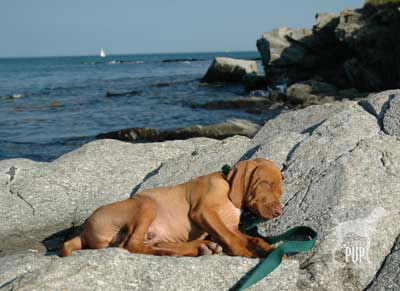
Within certain hours, dogs are allowed ON the beach, too, provided you follow the regulations. Kennebunk Beach is a great spot for your dog to run, swim, and enjoy the company of the myriad other dogs and dog owners you’ll find. Do note that in the summer, nearby parking requires a beach permit.

Want to spend a full day exploring the Kennebunks with your dog? If it’s between June 15 and the day after Labor Day, time your romp on Kennebunk Beach to be either before 9 AM or after 5 PM. For the rest of the day, consider heading to Kennebunk’s very own dog park just a short drive from the beach up Sea Road. This fenced-in dog park shares an entrance with Kennebunk’s recycling center and is open daily from dawn to dusk. Still have energy to burn? From the dog park, go across Sea Road into the parking lot for Sea Road School. On the left-hand side, you’ll be able to access the trailhead for the Bridle Path, going southeast. Since it’s the former rail bed for the Boston & Maine Railroad from 1883, it’s pretty flat. For a little ways you’ll snake behind neighborhoods, but before long, you’re surrounded by woods and marshland. Keep your eyes peeled for glimpses of the Mousam River to the west; it’s a favorite for birders and kayakers. In this direction, the trail ends in about 2 miles at the junction with Western Avenue. Reward yourself and your dog for a day well-spent by heading into the heart of nearby Kennebunkport. In the heart of Dock Square, you’ll find Scalawags, a marvelous pet boutique, where a bowl of fresh water always awaits. Owner Mary Beth does a great job of sourcing tasty dog treats and an array of truly unique Maine-made and Maine-inspired wares (think rope leashes hand-crafted by Maine lobstermen!) for your four-legged friends. Extending your stay is always an option, and you’re in luck in that the Kennebunks are home to a number of pet-friendly accommodations like the Captain Jefferds Inn, the Colony Hotel, and the Hounds Tooth Inn.


GREATER PORTLAND AND CASCO BAY

43°39′02.59″ N, 70°11′41.37″ W
Peaks Island, Maine

Peaks IslandTeam Tavish dug back into the Intrepid Pup archives for this pic of an approximately 11-week-old Tavish on one of his very first trips to what would become a frequent destination: Peaks Island. Of the several hundred island communities that dot Casco Bay, Peaks is the most populous with ~1,100 year-round residents, though that number swells to 4,000+ during the summer months. Peaks is actually part of the City of Portland, but its history has been punctuated by various—and as yet, unsuccessful—secessionist movements. It’s accessible via a 15-minute ride from downtown Portland on the Casco Bay Lines ferry and is thus a popular day-trip destination. Vehicle traffic is minimal, with bicycles and golf-carts easily outnumbering cars on the roads. At just 2 miles long and about a mile wide, Peaks is both walkable and eminently picturesque.
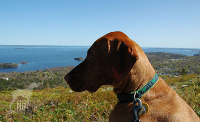
Dogs are allowed on the ferry but do need their own tickets. Climb aboard and take a seat on the open-air top deck. It’s not uncommon to spot harbor seals en route. Once you arrive at the ferry landing on Peaks, walk up the ramp to Downfront, where you can fortify yourself with an ice cream cone. As you head out the door, hook a right to stay on  Island Avenue and go back past the ferry landing, a little park, and a few restaurants. Within about 1/4 mile, the road will curve inland. Make a right on Whitehead and look for the short walking trail that leads down to Picnic Point and Hadlock Cove, where this photo of Tavish was taken. Here’s your craggy coastline and a stunning view of Casco Bay! If you bring along a picnic and a camera and never get any further in exploring Peaks, you won’t be disappointed. There is, however, much more to see. For a longer walk, rejoin the main road heading east, and within a few hundred feet you’ll come upon the Fifth Maine Museum. Its Memorial Hall cottage was constructed in 1888 as a memorial and reunion site for members of the Fifth Regiment Maine Volunteer Infantry (1861-1864) active during the Civil War. The museum’s exhibitions and programming cover regimental history and, more broadly, various facets of the island’s settlement. The museum is also playing a key role in the statewide sesquicentennial commemoration of Maine’s role in the Civil War. Heading right (east) from the Fifth Maine Museum, Seashore Avenue passes the 8th Maine Regiment building (now a lodge) and then quickly opens onto panoramic shoreline vistas. Seashore Avenue makes a circuit of the island and winds up being a little more than a 3-mile walk, ultimately reconnecting to Island Avenue, delivering you past the quirky, seasonally-open Umbrella Cover Museum and right back to where you started at the ferry landing. You can trim your overall distance by turning off Seashore Avenue onto any of the roads that bisect the island (see map). If you have time to spare before catching your return ferry, enjoy Shipyard Brewing Company beverages and a meal at the Inn on Peaks. When outdoor seating is available, your dog can join you on the patio.

MIDCOAST

44°13′22.91″ N, 69°04′07.73″ W
Mount Battie, Camden Hills State Park, Camden, Maine

Mount BattieCamden, Maine is a charming Midcoast town with quaint shops and inns, great seafood, schooner charters, and a bustling autumn Windjammer Festival that spotlights Camden’s picturesque marina. It’s also great base from which to undertake some hiking. Just over a mile outside the town center, heading north on Belfast Road/Route 1, is the main entrance on the left to Camden Hills State Park. The 30+ miles of trails are well-maintained and well-marked, but they do intersect one another frequently within the park’s 5,700 acres, so it helps to request a map at the ranger station and have a ranger suggest an appropriate route, based upon the time you have available.

A favorite of Team Tavish is the Mount Battie Trail, which is accessed from the parking area just beyond the ranger station. While the trail isn’t technically challenging (heck, it even crisscrosses the auto road to the summit, but driving up would be “cheating”!), it’s a lovely couple miles of walking in the woods, and the payoff is huge. The trail tops out at a smooth rock outcropping 780′ above sea level with a breath-taking view of Camden Harbor immediately below and Penobscot Bay beyond. In autumn, leaf-peeping and spotting the migrating hawks are additional draws. For a longer foray, daisy-chain the trails and try out Bald Mountain (1200′), Mount Megunticook (1385′), or Maiden Cliff (800′).

Word has it that the next Great Maine Outdoor Weekend is already slated for September 28-30, 2012.  Stay tuned for the Intrepid Pup to share more of his favorite Maine excursions then!


“…First in the Hearts of his Countrymen….”

 
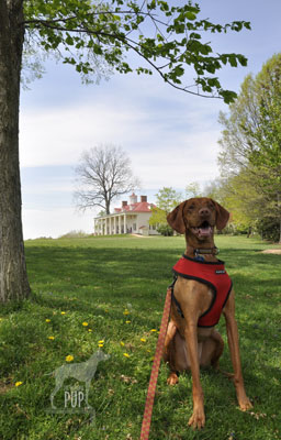
Tavish at Mount Vernon“First in war, first in peace and first in the hearts of his countrymen….” 
 

When it comes to being truly intrepid, one has to look no further than America’s first president, George Washington. The above words were spoken by Henry “Light-Horse Harry” Lee in 1799 in a public eulogy upon Washington’s untimely death and have aptly endured for generations.

With George Washington’s 280th birthday approaching on February 22, 2012, Team Tavish figured that Washington’s Mount Vernon Estate and Gardens would be a fitting topic for the Intrepid Pup’s inaugural blog post.

The extensive grounds are indeed dog-friendly (see “Dogging the Details” below), perhaps in a nod to Washington’s own affinity for dogs. In a tidbit of canine trivia, Washington is credited as being the father of the American Foxhound breed. He imported several hounds from England in 1770 and received more from France’s Marquis de Lafayette in 1785. According to the American Kennel Club, more than 30 hounds are referenced in Washington’s records, and it isn’t difficult to imagine them accompanying Washington as he surveyed, hunted, and managed the 8,000+ acres that once constituted the full extent of his Mount Vernon estate.

Tavish has visited on multiple occasions. He has had to leave touring the meticulously-restored mansion and experiencing the impressive educational complex—which opened in 2006 and comprehensively addresses various aspects of Washington’s public and private persona and legacy through immersive presentations, interpretive exhibitions, and more than 1,000 artifacts—to Team Tavish. But if you think there might not be much else for a dog to do, you’d be wrong. Consider sitting in one of the Windsor chairs on the back porch and admiring the sweeping view of the Potomac River. Explore the treading barn at the Pioneer Farm site and sniff the blooms grown from heirloom seeds in the ever-changing gardens. Walk solemnly past Washington’s tomb and the slave burial ground memorial. Greet visitors arriving by boat down at the dock. Peer through the fences and snuffle at any number of heritage breed animals that include hogs, oxen, and even Liberty (the National Thanksgiving Day turkey officially pardoned by President Obama on November 23, 2011, living out its days at Mount Vernon)! And if it’s the holiday season, follow in Tavish’s paw prints and be sure to check out the live camel. It’s true. During the Christmas season of 1787, George Washington paid 18 shillings for the novelty of temporarily boarding a camel to entertain his holiday guests. Mount Vernon keeps with the tradition by having a “Christmas Camel” on site during its annual Christmas at Mount Vernon festivities.

Dogging the Details

38°42′29.65″ N,  77°05′07.67″ W
George Washington’s Mount Vernon Estate & Gardens, Alexandria, Virginia

wag-a-meter set at 2Bring your annual pass, dog, and a leash! Mount Vernon earns a “2” on the Intrepid Pup Wag-A-Meter for generously giving annual pass holders dog-walking rights on the grounds during regular daytime visitation hours. If you plan to visit Mount Vernon more than once in any given year, then the annual pass is well worth it.  The usual rules apply:  keep your dog on a leash and be sure to clean up. Dogs aren’t allowed in the mansion, outbuildings, Ford Orientation Center, or Donald W. Reynolds Museum and Education Center, but with ~500 acres of grounds, gardens, and woodland trails, there’s plenty outside to explore. Mount Vernon has a few strategically-placed water bowls on the grounds for its canine friends, but if you’re planning an extended visit, bring along extra water for your dog. Mount Vernon attracts approximately 1 million visitors annually. On President’s Day, admission to Mount Vernon is free, but be forewarned that it’s also one of the Estate’s busiest days of the year!