A Tail at Three Sites

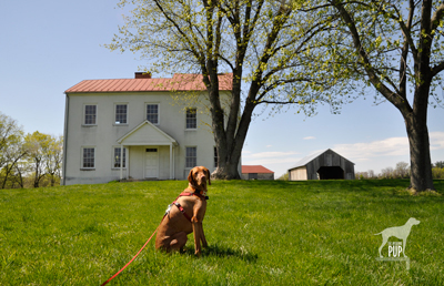
Tavish at Best Farm, Monocacy National Battlefield

Tavish at Best Farm, Monocacy National Battlefield

Many are the lessons that can be learned from historical sites, and a visit to Maryland’s Monocacy National Battlefield a few weeks ago was no exception. For Tavish the Intrepid Pup, the teachable moment came from a “stimulating” encounter snuffling the grass around a low-voltage electric fence by the cow pasture at the Worthington Farm site. (Note: no worries, he’s fine…just a lot more observant now when it comes to fences.) For Team Tavish, it was the realization that were it not for what happened at Monocacy back on July 9, 1864, the Civil War might have taken a different turn.

The battle at Monocacy represented the third and final Confederate invasion of the North. It often doesn’t get its due in history books because of the more epic scale of the previous two invasions at Antietam (1862) and Gettysburg (1863). But Monocacy is intriguing in its own right. With great irony, it was the Union army loss of the battle that actually saved the nation’s capital a mere 47 miles away. There are far greater chroniclers of Civil War battle strategy than the Intrepid Pup, but the basic storyline of Monocacy is this:  Ulysses S. Grant was beginning to successfully deter Robert E. Lee’s Confederate forces in the east. To sustain the pressure on those forces, Lt. General Grant was diverting to Richmond fresh reinforcements in the form of seasoned troops from the various forts that protected Washington, D.C. With relatively few soldiers left behind to “mind the store” so to speak, Lee recognized an opportunity and tasked Lt. General Jubal Early (1816-1894) with making a relatively quick run north up the Blue Ridge to cross at Harper’s Ferry and then invade the capital from the northwest. Early and his men very nearly succeeded except for  intervention from an unlikely source: John Garrett. Personally, Garrett was a Confederate sympathizer. Professionally, however, Garrett was the president of the Baltimore and Ohio (B&O) Railroad with many of his clients and much of his business centered in Union territory. It was he who alerted Major General Lew Wallace, stationed in Baltimore, to Early’s troop movements. Wallace had precious little time to react and even fewer resources to muster, but with an inexperienced band of 2,800 short-term recruits (i.e. not battle trained), he set out to intercede Early. The good news for Wallace was that by the time he encountered Early’s Confederate forces at Monocacy on July 9, his Union ranks had swelled to 5,800. The bad news for Wallace was that he was still outnumbered three to one. Imagine going into battle with full knowledge that the odds are squarely not in your favor.

The battle played out over about 12 hours amid several farmers’ fields and along a rail bed and the banks of the Monocacy River…you can still “read” the battle in the landscape today. By almost any measure, Wallace had been defeated and had lost nearly a quarter of his men in the process. Yet Early hadn’t expected to meet such resistance at Monocacy, and the fighting cost him some 900 men and critical hours. With no choice but to encamp on the battlefield the night of July 9, Early had effectively lost a day—and the element of surprise—in an already tight timeline. Early’s men pushed onward the next morning and reached the northwest boundary of Washington by the following afternoon to mount an attack on Fort Stevens. The delay, however, had given Grant just enough time to send steamships full of soldiers to repopulate the defensive forts around Washington. So, while the fighting at Fort Stevens on July 11 was fierce and deadly, it was not enough to fully infiltrate the nation’s capital. Early withdrew, ultimately unsuccessful in his mission.

Tavish at Fort Stevens

Tavish at Fort Stevens. President Abraham Lincoln went to witness the fighting here on July 11, 1864. Confederate sharpshooters aimed for him, making Lincoln the only U.S. President to come under direct enemy fire in time of war.
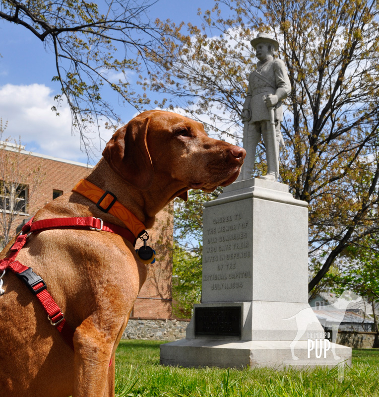
Tavish at Battleground National Cemetery

Tavish at Battleground National Cemetery

Fifty nine Union soldiers lost their lives in the Battle of Fort Stevens—the only Civil War battle to be waged in the District of Columbia—and 41 were buried the evening of July 12 at a site a half mile north of the fort on the battleground itself. President Lincoln attended the interment ceremony and consecrated the land as hallowed ground. Now known as Battleground National Cemetery, this tiny plot of land on Georgia Avenue, N.W. between Van Buren Street and Whittier Place is among America’s smallest national cemeteries. Added over the years were various monuments commemorating the regiments that fought, as well as several plaques bearing such sentiments as: “The muffled drums’ sad roll has beat the soldier’s last tattoo. No more on life’s parade shall meet that brave and fallen few.” There’s also a stone superintendent’s house designed by General Montgomery Meigs (1816-1892), a veteran of the Battle of Fort Stevens and also the architect/engineer of DC’s Pension Building that today houses the National Building Museum.

And what ever happened to Major General Wallace (1827-1905)? Yes, he lost the battle but survived the war and, interestingly enough, went on to write the famous novel Ben-Hur: A Life of the Christ (1880). His book was subsequently adapted for the silver screen several times, with the most notable version being the 1959 film classic (starring Charlton Heston and his famous chariot race scene) that reaped 11 Academy Awards.

Dogging the Details
Click to see what 2 on the Wag-A-Meter means39°22′37.90″N, 77°23′43.34″W
Monocacy National Battlefield
, Frederick, Maryland

38°57′52.05″N, 77°1′44.67″W
Fort  Stevens, Washington, DC

38°58′14.69″N, 77° 1′37.23″W
Battleground National Cemetery, Washington, DC

Monocacy NB

Tavish among the bluebells on the Ford Loop Trail, Monocacy National Battlefield

Because of the three sites’ relatively close proximity to one another, tracing the full story of Monocacy—from the initial battle in Frederick, Maryland, to the conclusion at the tiny cemetery in Washington—is easy to experience in one very full day or over the course of two  leisurely days. There’s the most ground to cover at Monocacy National Battlefield. Begin your foray at the visitors’ center on Urbana Pike. It used to be in smaller quarters at the Gambrill Mill site but moved to this nice new building about five years ago. Although dogs aren’t allowed inside the visitor center, make sure you head upstairs. There’s a succinct yet exceptionally comprehensive exhibition with an overhead timeline, lighted battle map, and several interactives that really help put what you’re about to see outside in a broader context. Be sure to pick up a brochure from the ranger, because it contains not only driving directions but also a trail map. There are 5 separate locations within the national park to get out explore with your dog. As always, dogs are to be leashed and picked up after:

  • While Best Farm and Monocacy Junction don’t have any trailheads per se, there’s plenty of room to explore the immediate vicinities from the parking areas. Best Farm is also associated with a remarkable 1862 event related to Antietam (Learn more at the visitors’ center or Google “Lee’s Lost Orders”!).
  • During the battle, the Gambrill Mill site was co-opted as a Union field hospital, and the short loop trail here includes a boardwalk section leading to the Monocacy River. Tavish enjoyed wading in the shallows.
  • The Thomas Farm site contains two loop trails that wind through the farm fields that withstood the heaviest fighting that day in 1864.
  • Worthington Farm has the longest trails, though neither of the two loops takes more than a half hour to hike. We went on a Sunday afternoon and had the place mostly to ourselves save for a couple joggers. The Ford Loop Trail is flat and hugs the flood plain of the Monocacy River. Should you happen to time it right in the springtime, as we did by happy coincidence, you’ll find the path to be spectacularly carpeted with Virginia bluebells (see photo). Much of the Brooks Hill Loop Trail borders the aforementioned cow pasture. Fresh from his fence episode, Tavish curiously appraised the gangly calves and their moms from a respectful distance. Once the trail enters woodland it quickly gains elevation, topping out on a ridge with an expansive view across emerald farmland toward Thomas Farm.

Back in the District of Columbia, visiting Fort Stevens simply involves snagging a parking spot on the street or in the neighboring church parking lot. All that remains of the once extensive Civil War Defenses of Washington are more than 20 locations throughout DC-MD-VA ranging from simple forest sites to earthworks to full-fledged forts. Fort Stevens is not staffed but does have a couple interpretive panels to orient visitors to the partial reconstruction. Continue the short distance to conclude your journey by parallel parking on Georgia Avenue in front of Battleground National Cemetery.

A Grotto with a View: Olmsted’s Dog-Friendly Legacy

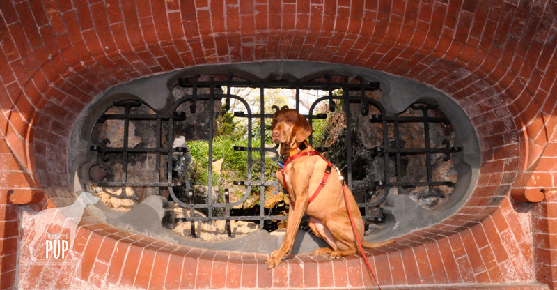
Tavish at the Summerhouse grotto on Capitol Hill

Today—April 26, 2012—is Frederick Law Olmsted Sr.’s 190th birthday. The Intrepid Pup is pretty sure Olmsted’s birthday isn’t widely celebrated nationwide, but it should be! After all, it’s because of Frederick Law Olmsted Sr. (1822-1903) that the terms landscape architecture, green space, and parkway are even part of our vocabulary.

Olmsted’s life is well-chronicled. An early writing and publishing career took the turn to landscape design when in 1857 he secured the position of superintendent of New York City’s Central Park. With a design competition for the park underway, Olmsted was approached by London architect Calvert Vaux (1824-1895), and together they submitted what ended up being the award-winning plan. In 1865 they formed Olmsted, Vaux & Company, a partnership lasting seven years, but eventually Olmsted’s reputation eclipsed Vaux’s. Olmsted would go on to found his own firm, which he relocated to the Boston suburbs in 1883. Today, the National Park Service maintains Olmsted’s Brookline design office “Fairsted” as the Frederick Law Olmsted National Historic Site. Prior to Olmsted’s retirement in 1897, he and his firm had executed approximately 500 commissions, notably including the landscape design for the 1893 Chicago World’s Fair, Boston’s Emerald Necklace park lands, Detroit’s Belle Isle, the Stanford University campus, and Asheville’s Biltmore Estate. Olmsted’s nephew/stepson John Charles Olmsted (1852-1920) and son Frederick Law Olmsted Jr. (1870-1957) joined the firm and became full partners, successfully perpetuating Olmsted’s original design aesthetics and the family business well into the 20th century. Both men were founding members of the American Society of Landscape Architects. Frederick Jr. in particular became an adviser to a nascent National Park Service, and his influence can be readily identified in such parks as Yosemite and Acadia.

*  *  *

Where there are parks, there is Tavish, so clearly the Intrepid Pup thing to do in honor of Olmsted Sr.’s birthday is to visit an Olmsted landscape. In Tavish’s case, it’s the grounds of the United States Capitol.

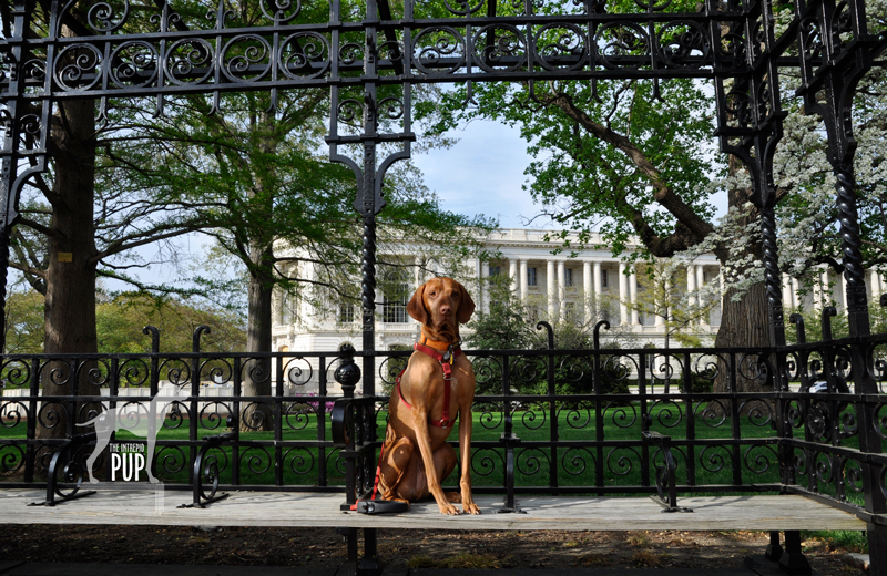
The mid 19th-century Capitol expansion responsible for adding the massive wings and installing a larger dome also necessitated attention to the surroundings. Frederick Law Olmsted Sr. presented a landscaping plan in 1874 and was brought in to oversee its implementation. What were by that time hallmarks of Olmstedian design—scenery, winding paths, integrated topography—were once again employed to the task at hand. Olmsted was cognizant that the Capitol itself was to be the centerpiece of the immediate landscape and thus created a pastoral expanse. He meticulously laid out the walkways and placement of more than 7,800 trees to create very intentional vistas. While he went fairly minimalist on exterior fountains and statuary so as not to distract or detract from the Capitol itself, Olmsted specified ornamental lamps and wrought iron streetcar shelters (thankfully still in place…see photo below!) to subtly harmonize with the overall design. In 1879, he began work on an open-air, hexagonal brick Summerhouse on the west, Senate-side lawn. An absolutely enchanting structure, neatly embedded among heavy vegetation along a sinuous path, it’s probably a safe assumption that many of the 3.5 million modern-day annual visitors to the Capitol never notice it. Yet step inside the Summerhouse, and it’s a little world unto its own. The thick brick walls keep it cool on even the sultriest of DC days, and the stone benches set into the alcoves can accommodate up to 22 people. In the center is a burbling fountain; originally, the cascading water was supposed to activate a series of musical chimes, but the mechanics were never quite right, so that feature was abandoned. Two oblong, rondel-like windows perforate the walls, but the third—fronted by a lattice of  ornamental grillwork—affords the view of a small grotto (see Tavish’s photo above). The effect is not unlike that of peering through the opening of one of those panoramic sugar Easter eggs to behold a magical scene.

Olmsted intended the Summerhouse as a place for travelers to regroup and perhaps ladle refreshment from the fountain. More than a century later, the Summerhouse’s role is unchanged, and it’s an apt spot for reflecting upon the considerable Olmsted legacy.

Tavish on Capitol Hill

Dogging the Details

38°53′29.33″N, 77°0′38.33″W
The Summerhouse
on the grounds of the U.S. Capitol, Washington, DC

Click to see what a "1" on the Wag-a-meter meansThe U.S. Capitol grounds, including the Summerhouse, are dog-friendly, but you must keep dogs on leash and pick up any waste. It’s worth noting that, for security reasons, you won’t find public trash receptacles in close proximity to the Capitol perimeter.

The central fountain is no longer fed by a spring, and the three drinking fountains surrounding it supply filtered DC water, so it’s safe for drinking…or for refilling a travel bowl for your dog!

The Olmsted grounds score a “1” on the Intrepid Pup Wag-a-Meter as they’re expansive, scenic, walkable, and easily accessible.

Save

Save

Thanks, Teddy!

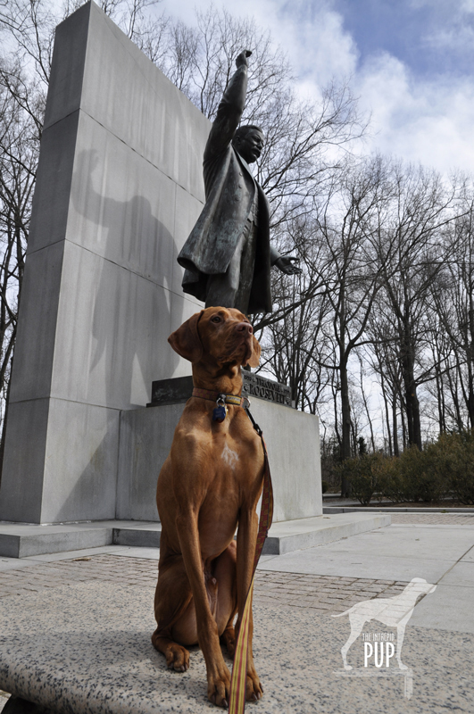
Tavish at Roosevelt Island If you’re as big a fan of America’s national parks as Tavish the Intrepid Pup, then National Park Week is like having Christmas, a birthday, and the 4th of July all rolled into one. In 2012 National Park Week runs from April 21 through April 29. Jointly promoted by the National Park Service (NPS) and the National Park Foundation—the parks’ official charity—National Park Week collectively celebrates the 84 million acres preserved as “America’s best idea” by offering free admission to all 397 national park sites throughout the country. To be fair, more than 250 of these are free year-round, but in going fee free system-wide for a week, cost simply can’t be an excuse for not visiting a national park. So, in the spirit of Intrepid Pup:  “Come! Adventures Await.”©
Throughout the week, Intrepid Pup will highlight various NPS sites he’s visited recently, so check back often! In the meantime, we’re starting with the Theodore Roosevelt Island National Memorial because, seriously, where better to step off National Park Week than the place dedicated to the guy who first made the environment and national parks central to domestic policy?

Theodore Roosevelt (1858-1919) became the the youngest man to ascend to the U.S. presidency, taking over when President McKinley’s term ended prematurely with an assassin’s bullet. While Roosevelt can’t lay claim to designating Yellowstone the country’s first national park (President Grant had that honor in 1872) or even to establishing the National Park Service (President Wilson got the credit in 1916), he arguably did more to shape the tenor of American resource conservation than any president before or since. During Roosevelt’s 1901-1909 tenure as the 26th president of the United States, he created five national parks and established the U.S. Forest Service. With the passage of the 1906 Antiquities Act he provided the precedent and legislative vehicle for presidents to protect historically significant sites as National Monuments…of which he then personally authorized 18. All told, among national forests, parks, game preserves, bird reservations and national monuments Roosevelt amassed a legacy of preserving a staggering 230 million acres of public land.

To visit Roosevelt Island today is to step onto a sylvan oasis. Wedged between Virginia and the District of Columbia’s banks of the Potomac River, this 88-acre dollop has had a schizophrenic past:  Inhabited by 16th-century Native Americans. Overtaken by various colonials in the 18th century. Owned by George Mason (author of the Virginia Declaration of Rights) and later by his son in the early 19th century for entertaining high society in a summer house built upon its ridge. Utilized by the 1st U.S. Colored Troops as a Civil War mustering ground in 1863. Cherished as a safe haven for escaped and freed slaves fleeing the South between May 1864 and June 1865.

The Roosevelt connection didn’t come until the 1930s, when the Theodore Roosevelt Association acquired the island and promptly transferred title to the National Park Service. Initial efforts to create the only capital-area memorial to Roosevelt involved the Civilian Conservation Corps removing invasive vegetation and planting nearly 20,000 native trees. Frederick Law Olmsted Jr. (1870-1957) was enlisted to come up with an overall design. Various issues hampered progress, including World War II, and the project wasn’t resumed until the 1960s. Though Olmsted had passed away in the intervening years, many of his original ideas like a Memorial Plaza and foot trails survived the final plan put forth by Eric Gugler (1889-1974). Paul Manship (1885-1966)—perhaps better remembered for his Prometheus Fountain in New York City’s Rockefeller Center—designed the 17-foot bronze statue of Roosevelt ultimately dedicated on the site in 1967.

In Tavish’s visits to the island, we invariably begin at the expansive Memorial Plaza where Roosevelt stands at the far end, backed by a 30-foot granite shaft, right arm raised above his head as if he were in the midst of an animated speech. Four 21-foot granite tablets bear Roosevelt quotations under the headings of Nature,  Manhood, Youth, and The State. Three trails (Swamp, Woods, and Upland) radiate from the plaza; none are longer than 1.3 miles. Except for a traffic helicopter’s shadow raking through the tree canopy or the dull roar of a Dc-9 following the river southward on its final approach to Ronald Reagan-Washington National Airport, you’d never believe you’re so close to the city. Don’t go expecting dazzling waterfront views; for most of the year, heavy foliage occludes shoreline panoramas of the Kennedy Center, the Watergate and Georgetown. The Potomac River is tidal but it’s fresh water that infiltrates the marshland skirting the Swamp Trail’s boardwalk. On our most recent jaunt yesterday, yellow irises were in bloom. Low tide had temporarily marooned minnows in the shallows. We spotted numerous marsh birds and encountered three deer grazing on green tendrils mere feet from the boardwalk. Two salamanders basking in the sun skittered away when we approached.

Roosevelt Island is one of five NPS sites—if you don’t count his visage on Mount Rushmore—specifically honoring our 26th President. (Intrepid Pup bonus points if you can name the others! Answers are below.*) In hiking the island,  Roosevelt’s foresight for preserving parkland is readily appreciated. As one of his quotations chiseled in the nearby stone states:

“The nation behaves well if it treats the natural resources as assets
which it must turn over to the next generation increased and not impaired in value.”

Thanks, Teddy!

Dogging the Details

38°53′50.70″N, 77°3′50.22″W
 Theodore Roosevelt Island National Memorial, Virginia

Click to see what a "1" on the Wag-a-meter means By car, one can only reach the parking lot for Roosevelt Island from the northbound lanes of the George Washington Memorial Parkway. The  lot serves as a trailhead for runners and cyclists on more far-flung journeys along the Mount Vernon and Potomac Heritage Trails. Though most who park here likely never cross the pedestrian bridge onto the island, the grounds nonetheless attract a fair share of walkers and joggers. Dogs are permitted on the island but must be on a 6-foot leash at all times. As always, pick up after your dog. Trash receptacles are understandably sparse along the island’s trails but are abundant in the parking area.

Be aware that low-lying areas of the island flood easily, and sections of trail are seasonally boggy or otherwise closed. Consult the bulletin board on the island side of the pedestrian bridge for current trail info.  Bear right and make the first left uphill to view the Memorial Plaza; otherwise stay right to embark on the Swamp Trail that encircles the island. The Island scores a “1” on the Intrepid Pup Wag-a-Meter for its easy hiking.

*The other four Roosevelt-related NPS sites are Roosevelt National Park (North Dakota), the Roosevelt Birthplace National Historic Site (New York City), Sagamore Hill National Historic Site (Oyster Bay, NY), and the Roosevelt Inaugural National Historic Site (Buffalo, NY).

The Road to Freedom

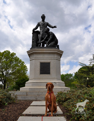
Tavish at the Freedmen's Memorial

It’s April 16th. In the District of Columbia, kids have the day off from the school, and DC government offices are closed. A parade has concluded, but the street festival will continue, culminating in a fireworks display just a few hours from now. What’s the occasion? DC Emancipation Day: widely celebrated for years but only officially made a DC public holiday by Mayor Anthony Williams in 2005.

While Abraham Lincoln’s Emancipation Proclamation of January 1, 1863, is what always makes the cut to be on virtually any timeline of the American Civil War, the fact of the matter is that the emancipation of slaves really began 8 1/2 months earlier. Presented with the District of Columbia Compensated Emancipation Act—first introduced by Massachusetts senator Henry Wilson in December 1861—President Lincoln signed it into law on April 16, 1862. The stroke of his pen granted instant freedom to 3,100 slaves in the nation’s capital and ended the abhorrent anomaly that slaves could be bought and sold within sight of the very bastions of a federal government simultaneously struggling to save a divided nation at war. The “compensated” portion of the Act entailed the government remunerating slave owners loyal to the Union with up to $300 for each slave; the government ultimately paid out nearly $1 million through a process managed by a three-person Emancipation Commission. In addition, former slaves were offered a $100 incentive should they opt to emigrate from the country, namely to Liberia or Haiti.

Lincoln must have had some satisfaction in enacting the legislation, since he had long believed gradual, compensated emancipation to be viable option in trying to run the gauntlet between outright abolition and the all-important preservation of the Union. Yet, interestingly, the compensation factor so prevalent in the DC act did not carry over to the more sweeping Emancipation Proclamation.

While the Freedmen’s Memorial Monument to Abraham Lincoln (pictured here during the Intrepid Pup’s recent visit) was actually erected in response to Lincoln’s Emancipation Proclamation of 1863, it’s equally relevant to remember it on today’s 150th anniversary of the DC Emancipation. Blocks from the Capitol Building in a park that was once the site of a Civil War hospital, the monument rises, a pedestal topped with a sculpture grouping designed by Thomas Ball (1819-1911). It depicts a newly-emancipated male slave kneeling before Abraham Lincoln. At the base, in capital letters, is the single word: EMANCIPATION. The memorial has been roundly criticized as reinforcing notions of paternalism, supplication and subservience. Indeed, the monument presents an image jarring to 21st-century sensibilities. As a run-up to this year’s 150th anniversary DC Emancipation festivities, the Washington Post just ran an article that included the Freedmen’s Memorial; one reader who’d grown up a stone’s throw from the park responded online, “I never liked that statue. Even as a child, I always thought they should be shaking hands.” But it’s also important to place the memorial within its historical context. As the plaque affixed to the rear of the monument reads:

Freedom’s Memorial
In grateful memory of Abraham Lincoln

This monument was erected by the Western Sanitary Commission of Saint Louis MO:
with funds contributed solely by emancipated citizens of the United States declared free by his proclamation January 1st A.D. 1863.
The first contribution of five dollars was made by Charlotte Scott a freed woman of Virginia being her first earnings in freedom and consecrated by her suggestion and request on the day she heard of President Lincoln’s death to build a monument to his memory.

The monument was dedicated on April 14, 1876, the 11th anniversary of Lincoln’s assassination. Frederick Douglass gave the keynote address before a reported crowd of 25,000. It’s clear from his remarks that he thought of the statue much more as a memorial to Lincoln than as a monument to the act of emancipation, and privately he, too, apparently expressed disappointment at how the figures were portrayed. Then, as now, public art encourages exploration and invites discussion.

Dogging the Details

38°53′23.26″N,  76°59′24.76″W
Freedmen’s Memorial Monument to Abraham Lincoln, Lincoln Park, Washington, DC

wag-a-meter set at 2As noted in an earlier Intrepid Pup posting related to Lincoln Park, the site of this statue is exceptionally dog-friendly (earning it a “2” on the Intrepid Pup Wag-a-Meter), with many people using it as a de facto dog park. It’s important to mention, however, that this is not an officially-designated city dog park. Rather, it’s maintained by the National Park Service, and the expected rules of conduct apply (e.g. keep your dog under your personal control and clean up).

The park is located at 12th Street and Massachusetts Avenue, NE and an easy walk due east from the U.S. Capitol. If arriving by car on a weekday, it’s not difficult to find free 2-hour parking nearby along the residential side streets.

A Titanic Fascination

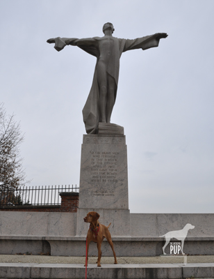
Titanic Memorial

99 years and 364 days ago, the approximately 2200 people aboard the RMS Titanic were four days into their trans-Atlantic voyage from Southampton to New York City and having a grand old time. That all changed the night of April 14, 1912, when an iceberg tore open her starboard side, and the unthinkable happened. Within just two and a half hours, in the early morning hours of April 15, the “unsinkable” ship had cataclysmically broken apart and plummeted to a watery grave 12,540 feet below. And the rest, as they say, is history.

*  *  *

Fast forward to a few weeks ago on the Washington, DC waterfront. An early twenty-somethings couple was sitting on the wall of the Titanic Memorial when we approached. Intrigued by the fact that Tavish the Intrepid Pup was being photographed, the young woman in the duo struck up a conversation and inquired about Tavish. Upon explaining to her that this was the latest monument in a growing list of ones he’s visited, she seemed thoughtful. “Hmm,” she said, “the Titanic. Yeah. I saw the movie.”  And then, a few moments later:  “So, what’s up with this memorial, anyway? Did the Titanic sink here?”

Aside from the egregious incongruity of her remark, she had actually made a good point:  why is there a Titanic Memorial in Washington, DC?  The Titanic most assuredly did not strike an iceberg in the nation’s capital, and DC’s Southwest Waterfront couldn’t look any less like the cold expanse of the North Atlantic. Indeed, there are other places with far more direct connections to the Titanic, like Belfast, where the ocean liner was built, or Fairview Lawn Cemetery in Halifax, where 121 of the victims are interred.

The reason, quite simply, is that a group of wealthy women, the Women’s Titanic Memorial Association, raised the funds in response to congressional authorization of a national monument. The winning design selected by the Fine Arts Commission consisted of a robed male figure designed by Gertrude Vanderbilt Whitney (1875-1942, of Whitney Museum of Art fame) standing amidst a granite exedra designed by architect Henry Bacon (1866-1924, of Lincoln Memorial fame). The memorial was completed in 1918, but it wasn’t until 1931 that it was installed and dedicated at the intersection of New Hampshire Avenue, NW and Rock Creek Parkway, on the riverbank. The base of the sculpture bears the inscription:

TO THE BRAVE MEN
WHO PERISHED
IN THE WRECK
OF THE TITANIC
APRIL15, 1912
THEY GAVE THEIR
LIVES THAT WOMEN
AND CHILDREN
MIGHT BE SAVED

Erected by the Women of America

Kirk Savage’s compelling book Monument Wars (University of California Press, 2009) includes a 1936 photograph of the memorial at this location, partially and disturbingly submerged during Potomac River flooding. In 1968 the memorial was relocated to its present location on the southwest waterfront near Fort McNair, as it had been removed two years before to make way for construction of the Kennedy Center for the Performing Arts.

In departing the Titanic Memorial and continuing our walk along the waterfront that afternoon, we encountered an older woman and her dog. We exchanged pleasantries and learned that she lived in the nearby Riverside Condominium complex. She’d observed that we’d come from the memorial and offhandedly remarked, “You know about the men in tuxedos, don’t you?” With a sly smile, she then launched into a seemingly apocryphal eyewitness account of a group of men who, since 1979, appear every year on April 15th at 12:30 a.m., dressed in formal wear, to place flowers at the memorial and offer up a champagne toast to the men who’d sacrificed their lives.  Haunting, but—as it turns out—absolutely true. The tuxedoed group is none other than the Men’s Titanic Society, which started out as a group of friends who wanted to honor the spirit and intent of what they saw as a forgotten memorial.

Though the DC memorial may have fallen off the public’s radar, the Titanic itself never did. In this 100th anniversary year, towns and museums far and wide are leveraging any Titanic connection they have, whether it’s a hometown family lost in the tragedy or a single artifact. And while this list is not exhaustive, there are currently substantive Titanic-related exhibits at the Maritime Museum of the Atlantic, Mystic Aquarium, National Geographic Museum, Titanic Belfast, Widener University Art Gallery, and Woods Hole Oceanographic Institution’s Ocean Science Exhibit Center. RMS Titanic, Inc., the company that controversially conducted salvage operations on the wreck site, has Titanic: The Artifact Exhibition on view at 8 distinct venues throughout the country, including a semi-permanent installation at the Luxor in Las Vegas. Separately, there are permanent Titanic Museum Attractions in Branson, Missouri, and Pigeon Forge, Tennessee. Alas, you’re too late to join the “Titanic Memorial Cruise” of the MS Balmoral that’s already underway, but you can catch the re-release of James Cameron’s 1997 film “Titanic” in 3D. Or you can read National Geographic’s newly-published e-book single about the Titanic. Prefer television? You have your choice this week of a History Channel documentary, two National Geographic specials, or an ABC mini-series. It all adds up to a somewhat macabre fascination of, well, titanic proportions. Why does the Titanic story still resonate after 100 years? For one, the Titanic was a cruise ship, and we still have those. It’s not an abstraction in the way that, say, a sunken 17th-century galleon might be. Secondly, in the grand scheme of things, 100 years isn’t really that long ago. The last survivor from the Titanic only died in 2009. There are people alive today who can tell of grandparents and great-grandparents aboard the ill-fated ship. One can relate, and the stories are all the more palpable. Third, positively identifying the wreck site in 1985 reignited interest and gave tantalizing hope to those seeking answers to Titanic’s multitude of unanswered questions. Your author (and one half of Team Tavish) grew up in the community that’s home to Woods Hole Oceanographic Institution (WHOI), the entity that backed the fabled 1985 exploratory expedition of Bob Ballard and crew. The frisson of excitement that rippled ’round the world upon the discovery of the Titanic was amplified locally; not only was the news historic, but also chances were you that your neighbor, your dad, or your friend’s parent had somehow been involved with the effort. Finally, when the Titanic sank, it violently intruded upon a cold and inhospitable world, introducing humanity—people, lifetimes, names, memories—where none had previously existed. This alone will be what perpetuates the Titanic’s legacy another 100 years.

Dogging the Details 38°52′18.90″N,  77° 1′9.68″W


Titanic Memorial, Washington, DC

Click to see what a "1" on the Wag-a-meter meansThe Titanic Memorial is located where P Street, SW dead-ends into the channel; once you’re in the vicinity, blue way-finding signs point you in the right direction. On a weekday, it’s pretty easy to find nearby parking either at meters by Arena Stage or in 2-hour spaces along 4th Street, SW. If traveling by Metrorail, the nearest stop is the Waterfront-SEU station at the intersection of M and 4th Streets, SW.

Visiting the memorial scores a “1” on the Intrepid Pup wag-a-meter for the easy, flat walk. The memorial is usually fairly deserted, although the  Titanic 100th anniversary fanfare is bound to raise its profile. The Southwest DC Heritage Project is holding an elaborate TITANIC 100 commemorative event at the memorial on April 14, 2012. The program will feature 50-foot archival images projected onto a nearby building, luminaries lit in memory of the 1,500 people who died, and a live performance of “Nearer My God to Thee,” the last song that the Titanic’s onboard musicians played before the ship sank.

One final note on the subject of the Titanic: research into nearly every conceivable angle of the voyage continues to turn up the occasional new tidbit. Among the latest is that there were apparently 12 dogs aboard the Titanic; only 3 survived.