Outdoors and on the Water

Pohick BayAre you indoors reading this?  If so, take it outside!

Today, June 9th, is officially National Get Outdoors Day (GO!). If you regularly follow Tavish the Intrepid Pup, you already know his affinity for being out and about, and he needs no further invitation to get outside. But the goals of “GO!” are to encourage first-time visitors to public lands and to reconnect youth to nature. “GO!” is one of a growing number of public initiatives in recent years to embrace such themes. Richard Louv’s best-selling book, Last Child in the Woods, sounded the alarm in 2008 about “nature-deficit” and the corollaries with childhood obesity, attention disorders, and more. As we’ve become more plugged in to what’s on a screen than what’s in our backyard, entities as disparate as the U.S. Forest Service (More Kids in the Woods), the NFL (Play60), the National Wildlife Federation (Be Out There), and First Lady Michelle Obama (Let’s Move!) have launched national campaigns to help reverse this trend.

There’s no doubt that Tavish’s own need for exercise and activity has helped members of Team Tavish maintain healthier lifestyles. And while Tavish’s exploits have gotten him outdoors in more than a dozen different states, it’s important to point out that connecting to nature needn’t be complicated nor involve expensive travel plans to far-flung locales. So in that spirit, we’re highlighting below a simple, low-cost excursion that took us to a regional park for an all-new outdoor experience for Tavish. In other words, if you can’t replicate this exact itinerary, we’re pretty sure you can do something similar in most parts of the country. So, hurry outside and enjoy!

Dogging the Details

38°40′25.27″ N, 77°9′55.13″ W
Pohick Bay Regional Park, Lorton, Virginia
Click to see what 2 on the Wag-A-Meter meansTavish has been on several boats (car ferries, tour boats, etc.) over the years, but he’d never been on anything of the “personal watercraft” variety… until his visit to Pohick Bay Regional Park. The park is one of 24 administered by the Northern Virginia Regional Park Authority. Its other claim to fame is that it’s the terminus of the Occoquan Water Trail, an extraordinary 40-mile route along two tributary waterways of the Chesapeake Bay.

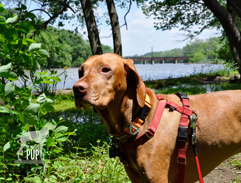
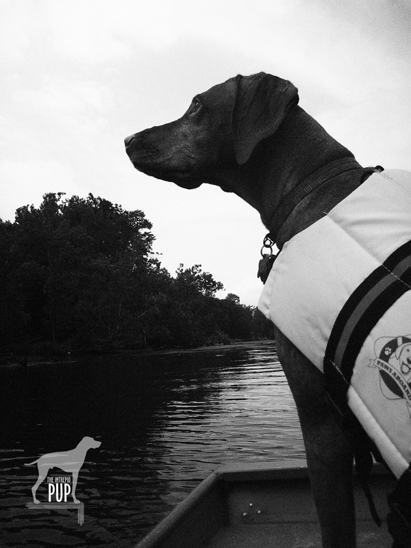
In addition to having woodland hiking paths, a marina, and expansive picnic areas, Pohick Bay Regional Park seasonally offers boat rentals for really reasonable hourly and day rates. If you don’t own a boat, it’s a great way to test out paddle boards, pedal boats, canoes, kayaks, sailboats and jon boats. Better yet, at this particular park you can bring your dog along on the rental! Intrepid Pup has an affinity for the water—ocean, stream, pond, you name it!—but he’s ultimately more of an enthusiastic splasher/wader than an active swimmer. At 45 lbs, a freaked out Tavish scrambling around on a canoe or sit-upon kayak offshore could be problematic. So since we didn’t quite know how he’d react to being out on the water, we opted for the stability of a jon boat. It’s essentially a sturdy, flat-bottomed metal rowboat with a low center of gravity (read: clunky tub really hard to capsize). Turns out we needn’t have worried as Tavish was more than happy to situate himself as close to the edge as possible to take in the scenery while one of us rowed (see photo above).

Clearly this was one outing where we expended way more energy than the Intrepid Pup did, but we got a good workout, saw several osprey and herons, and—perhaps most importantly—happily confirmed that boating with Tavish was something we could do again. We’d dearly love to get the Intrepid Pup out in a kayak, and the top choice (although it’s not among the rentals at Pohick Bay) to try would be Perception Kayaks’ new recreational model, the Prodigy 13.5. Its over-sized cockpit and a second removable half-seat are specifically designed with a “small companion” (be it a child or a dog) in mind. Brilliant!

The combination of a low boat rental rate and a high degree of fun earns this excursion a “2” on the Intrepid Pup’s Wag-a-Meter. Key things bring along for yourself include a snack, water, sunscreen, sunglasses, and a hat. For your dog, keep plenty of water aboard. Tavish’s short coat makes him especially susceptible to sunburn and/or overheating, so we had lots of water available for him to drink out of his collapsible travel bowl, and we made sure we didn’t stay out too long in the heat of day. One final note: Tavish wears a life vest when he’s on the water. Intrepid or no, it’s a wise move and potential life saver for humans and dogs alike.

Turtles, Goslings & Lily Pads, Oh My!

Tavish at Kenilworth Aquatic Gardens

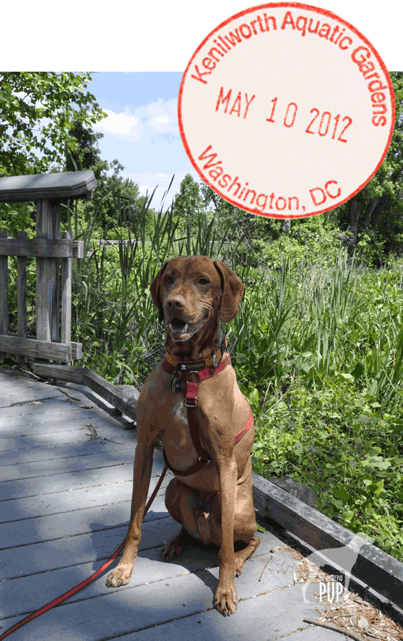
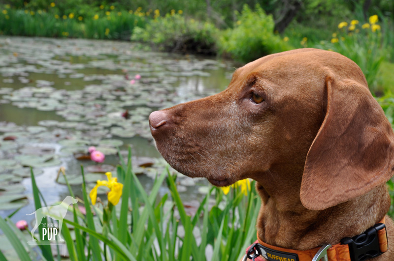
Tavish at the lily ponds. The hardy and tropical water lilies were blooming, little jewels of color amid the emerald green pads. Surrounding many of the ponds are irises, but the yellow variety is invasive. It is still too early for the lotus blossoms that are hallmarks of the summer months.

Even if today wasn’t National Public Gardens Day, we’d be touting Kenilworth Park & Aquatic Gardens. Did you know that it’s the only National Park Service site devoted to the cultivation and care of aquatic plants?

The precise story behind Kenilworth is one you couldn’t make up if you tried. Walter B. Shaw was a Civil War veteran who had lost his right arm in the fighting. He settled in Washington, D.C., securing a job as a Treasury Department clerk after teaching himself to write left-handed. Outside of government work, however, Shaw’s true love was water lilies. Eager to propagate them, he secured a dozen specimens from his home state of Maine and placed them in an unused ice pond on his 30 acres. When his hobby outgrew the one pond, he simply built more ponds until—under the auspices of the newly established W. B. Shaw Lily Ponds—he was successfully collecting exotic varieties, experimenting with hybrids, and commercially shipping plants nationwide. His daughter Helen Shaw Fowler joined him in his business ventures, and together they opened the gardens for the public’s enjoyment. Under Helen’s careful stewardship, the gardens expanded even further after Shaw’s death in 1921, and literally thousands of visitors a day (including President and Mrs. Coolidge!) flocked to marvel at the aquatic blooms during the summer months.

Fast forward to the 1930s and the U.S. Army Corps of Engineers was faced with dredging the silt-choked Anacostia River, an act that would have signaled the demise of the gardens. Helen fought the plans and an accord was reached in 1938 when Congress allocated $15,000 to purchase eight acres of the gardens for public preservation. Helen continued to live on the property until her death in 1953 but taught Fred Lundy, a gardener with the National Park Service, how to care for the water lilies. The Park Service eventually took over management of the garden and renamed it Kenilworth to reflect the name of the broader community. Today the park consists of 45 ponds of water lilies across 12 acres, enveloped by another 70 acres of freshwater tidal marshlands.

Midday yesterday Tavish the Intrepid Pup was eager to start exploring, and everything about his body language screamed, “What magical place is this, anyway?” Talk about sensory overload! At the lily ponds there were Canada geese (and therefore also a lot of goose droppings). We’d been advised by the park ranger when we arrived that there were several fledglings about, so we kept our distance. Tavish was actually pretty unphased by these tawny goslings paddling by…because there were BUTTERFLIES! And FROGS!  Ok, so technically we never saw a frog, but from the blurs of color and the loud splooshing sounds, we could tell they were big. It was great fun watching Tavish try to anticipate where the next blur and sploosh would come from. Oh, and the TURTLES! There were a few small painted turtles perched on logs, but they had nothing on the dinner platter-sized snapping turtles hanging out sunbathing at the ponds’ edges. These guys were perceptive and before we could come within ten paces it was like those targets in a county fair shooting gallery where each  toppled in succession with an unceremonious plunk. Invariably we were rewarded with a closer look when a few poked their heads back up out of the muddy water.

Tavish at Kenilworth Aquatic Gardens

Though hard to disengage Tavish from the endless fascinations of the lily ponds, we did finally make it onto the River Trail (note: NOT a loop; it’s 0.7 miles each way). It meanders in a northwesterly direction among the thick scent of honeysuckle and then follows the bend of the Anacostia River for a stretch. It ends at the inlet into the marsh itself, which is where you’d enter Kenilworth if coming by kayak or canoe. You never fully escape the incessant thrum of car traffic careening by on Route 50, punctuated by the occasional clatter of an Amtrak train crossing the railroad bridge. Where this might be overtly annoying in another setting, in a strange way, the noise serves notice that this fragile environment struggles to exist in spite of urban encroachment.

Returning to the lily ponds, we set out in the opposite direction onto the extensive boardwalk. Signs along the trail have faded considerably, but on this sunny, breezy afternoon we didn’t exactly need a plaque to tell us that the fish and tadpoles were plentiful. Tavish kept poking his head through the railing to watch them. Red-winged blackbirds darted among the tall grasses, and a great blue heron soared above. Just another spectacular day in the marsh.

Dogging the Details

38°54′45.50″N,  76°56′31.24″W
Kenilworth Park & Aquatic Gardens
, Washington, DC

Tavish at Kenilworth Aquatic Gardens

Click to see what 2 on the Wag-A-Meter means

It can be a little tricky navigating this residential area in northeast Washington to find the proper entrance to the aquatic gardens, so if you have GPS, use it!

Intrepid Pup has been to Kenilworth before, but it really pays to be a repeat visitor. While the walking trails are always nice, the visual appeal of the ponds changes dramatically throughout the seasons.

When we stopped in at the visitor center to snag a map, the Park Service ranger—a helpful young woman who, come to find out, was getting married this weekend at another National Park—was genuinely pleased to see us and remarked, “Kenilworth definitely welcomes leashed dogs!” The dog-friendly trails and scenery earn Kenilworth a “2” on the Intrepid Pup wag-a-meter. Of course, the general courtesy about cleaning up after your dog still very much applies, and there are waste receptacles conveniently located throughout the front section of the gardens (though not so much on the River Trail or boardwalk sections).  Tavish stayed in the vestibule of the Visitor Center as dogs aren’t permitted inside, but there is a small bookshop and a series of compact displays about the importance of the wetlands and the history of Kenilworth—from use as the fishing grounds of the Nacotchtank peoples through to the present day.

Walk every step of the grounds around the various ponds, out-and-back on the River Trail, and along the boardwalk, and you’ll be lucky to have eked out 2 miles. But you’ll easily have whiled away an hour or two, especially if you have a curious pup intently stalking every lily pad fluttering in the breeze!

A Tail at Three Sites

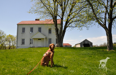
Tavish at Best Farm, Monocacy National Battlefield

Tavish at Best Farm, Monocacy National Battlefield

Many are the lessons that can be learned from historical sites, and a visit to Maryland’s Monocacy National Battlefield a few weeks ago was no exception. For Tavish the Intrepid Pup, the teachable moment came from a “stimulating” encounter snuffling the grass around a low-voltage electric fence by the cow pasture at the Worthington Farm site. (Note: no worries, he’s fine…just a lot more observant now when it comes to fences.) For Team Tavish, it was the realization that were it not for what happened at Monocacy back on July 9, 1864, the Civil War might have taken a different turn.

The battle at Monocacy represented the third and final Confederate invasion of the North. It often doesn’t get its due in history books because of the more epic scale of the previous two invasions at Antietam (1862) and Gettysburg (1863). But Monocacy is intriguing in its own right. With great irony, it was the Union army loss of the battle that actually saved the nation’s capital a mere 47 miles away. There are far greater chroniclers of Civil War battle strategy than the Intrepid Pup, but the basic storyline of Monocacy is this:  Ulysses S. Grant was beginning to successfully deter Robert E. Lee’s Confederate forces in the east. To sustain the pressure on those forces, Lt. General Grant was diverting to Richmond fresh reinforcements in the form of seasoned troops from the various forts that protected Washington, D.C. With relatively few soldiers left behind to “mind the store” so to speak, Lee recognized an opportunity and tasked Lt. General Jubal Early (1816-1894) with making a relatively quick run north up the Blue Ridge to cross at Harper’s Ferry and then invade the capital from the northwest. Early and his men very nearly succeeded except for  intervention from an unlikely source: John Garrett. Personally, Garrett was a Confederate sympathizer. Professionally, however, Garrett was the president of the Baltimore and Ohio (B&O) Railroad with many of his clients and much of his business centered in Union territory. It was he who alerted Major General Lew Wallace, stationed in Baltimore, to Early’s troop movements. Wallace had precious little time to react and even fewer resources to muster, but with an inexperienced band of 2,800 short-term recruits (i.e. not battle trained), he set out to intercede Early. The good news for Wallace was that by the time he encountered Early’s Confederate forces at Monocacy on July 9, his Union ranks had swelled to 5,800. The bad news for Wallace was that he was still outnumbered three to one. Imagine going into battle with full knowledge that the odds are squarely not in your favor.

The battle played out over about 12 hours amid several farmers’ fields and along a rail bed and the banks of the Monocacy River…you can still “read” the battle in the landscape today. By almost any measure, Wallace had been defeated and had lost nearly a quarter of his men in the process. Yet Early hadn’t expected to meet such resistance at Monocacy, and the fighting cost him some 900 men and critical hours. With no choice but to encamp on the battlefield the night of July 9, Early had effectively lost a day—and the element of surprise—in an already tight timeline. Early’s men pushed onward the next morning and reached the northwest boundary of Washington by the following afternoon to mount an attack on Fort Stevens. The delay, however, had given Grant just enough time to send steamships full of soldiers to repopulate the defensive forts around Washington. So, while the fighting at Fort Stevens on July 11 was fierce and deadly, it was not enough to fully infiltrate the nation’s capital. Early withdrew, ultimately unsuccessful in his mission.

Tavish at Fort Stevens

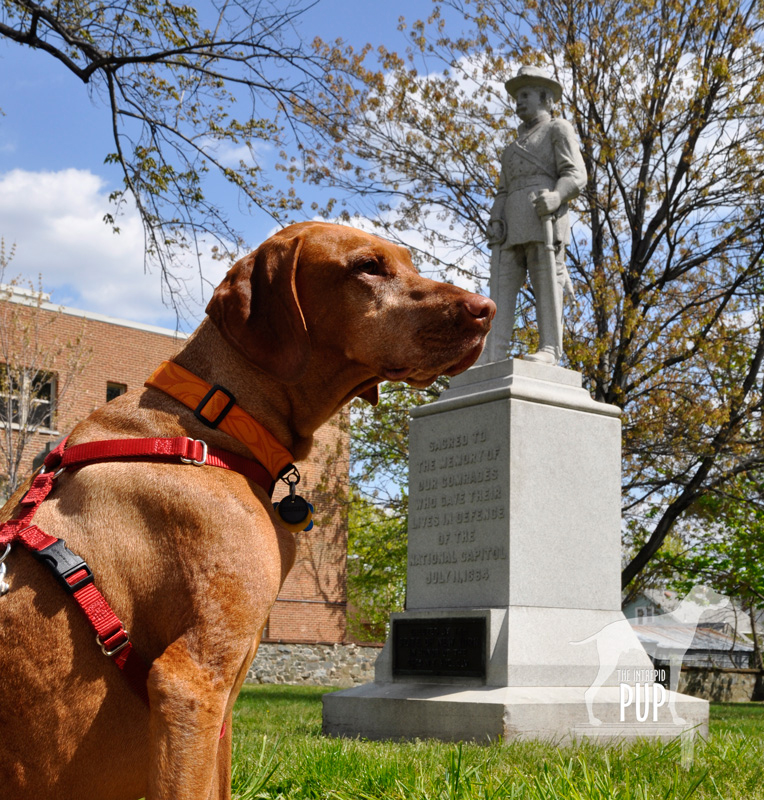
Tavish at Fort Stevens. President Abraham Lincoln went to witness the fighting here on July 11, 1864. Confederate sharpshooters aimed for him, making Lincoln the only U.S. President to come under direct enemy fire in time of war.

Tavish at Battleground National Cemetery

Tavish at Battleground National Cemetery

Fifty nine Union soldiers lost their lives in the Battle of Fort Stevens—the only Civil War battle to be waged in the District of Columbia—and 41 were buried the evening of July 12 at a site a half mile north of the fort on the battleground itself. President Lincoln attended the interment ceremony and consecrated the land as hallowed ground. Now known as Battleground National Cemetery, this tiny plot of land on Georgia Avenue, N.W. between Van Buren Street and Whittier Place is among America’s smallest national cemeteries. Added over the years were various monuments commemorating the regiments that fought, as well as several plaques bearing such sentiments as: “The muffled drums’ sad roll has beat the soldier’s last tattoo. No more on life’s parade shall meet that brave and fallen few.” There’s also a stone superintendent’s house designed by General Montgomery Meigs (1816-1892), a veteran of the Battle of Fort Stevens and also the architect/engineer of DC’s Pension Building that today houses the National Building Museum.

And what ever happened to Major General Wallace (1827-1905)? Yes, he lost the battle but survived the war and, interestingly enough, went on to write the famous novel Ben-Hur: A Life of the Christ (1880). His book was subsequently adapted for the silver screen several times, with the most notable version being the 1959 film classic (starring Charlton Heston and his famous chariot race scene) that reaped 11 Academy Awards.

Dogging the Details

Click to see what 2 on the Wag-A-Meter means39°22′37.90″N, 77°23′43.34″W
Monocacy National Battlefield
, Frederick, Maryland

38°57′52.05″N, 77°1′44.67″W
Fort  Stevens, Washington, DC

38°58′14.69″N, 77° 1′37.23″W
Battleground National Cemetery, Washington, DC

Monocacy NB

Tavish among the bluebells on the Ford Loop Trail, Monocacy National Battlefield

Because of the three sites’ relatively close proximity to one another, tracing the full story of Monocacy—from the initial battle in Frederick, Maryland, to the conclusion at the tiny cemetery in Washington—is easy to experience in one very full day or over the course of two  leisurely days. There’s the most ground to cover at Monocacy National Battlefield. Begin your foray at the visitors’ center on Urbana Pike. It used to be in smaller quarters at the Gambrill Mill site but moved to this nice new building about five years ago. Although dogs aren’t allowed inside the visitor center, make sure you head upstairs. There’s a succinct yet exceptionally comprehensive exhibition with an overhead timeline, lighted battle map, and several interactives that really help put what you’re about to see outside in a broader context. Be sure to pick up a brochure from the ranger, because it contains not only driving directions but also a trail map. There are 5 separate locations within the national park to get out explore with your dog. As always, dogs are to be leashed and picked up after:

  • While Best Farm and Monocacy Junction don’t have any trailheads per se, there’s plenty of room to explore the immediate vicinities from the parking areas. Best Farm is also associated with a remarkable 1862 event related to Antietam (Learn more at the visitors’ center or Google “Lee’s Lost Orders”!).
  • During the battle, the Gambrill Mill site was co-opted as a Union field hospital, and the short loop trail here includes a boardwalk section leading to the Monocacy River. Tavish enjoyed wading in the shallows.
  • The Thomas Farm site contains two loop trails that wind through the farm fields that withstood the heaviest fighting that day in 1864.
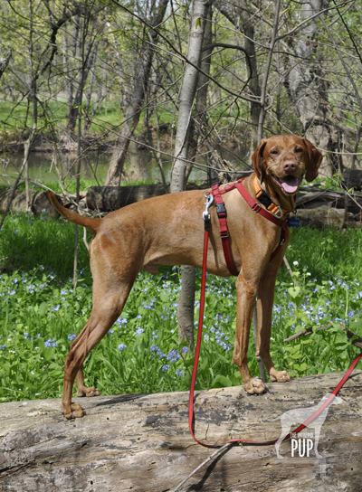
  • Worthington Farm has the longest trails, though neither of the two loops takes more than a half hour to hike. We went on a Sunday afternoon and had the place mostly to ourselves save for a couple joggers. The Ford Loop Trail is flat and hugs the flood plain of the Monocacy River. Should you happen to time it right in the springtime, as we did by happy coincidence, you’ll find the path to be spectacularly carpeted with Virginia bluebells (see photo). Much of the Brooks Hill Loop Trail borders the aforementioned cow pasture. Fresh from his fence episode, Tavish curiously appraised the gangly calves and their moms from a respectful distance. Once the trail enters woodland it quickly gains elevation, topping out on a ridge with an expansive view across emerald farmland toward Thomas Farm.

Back in the District of Columbia, visiting Fort Stevens simply involves snagging a parking spot on the street or in the neighboring church parking lot. All that remains of the once extensive Civil War Defenses of Washington are more than 20 locations throughout DC-MD-VA ranging from simple forest sites to earthworks to full-fledged forts. Fort Stevens is not staffed but does have a couple interpretive panels to orient visitors to the partial reconstruction. Continue the short distance to conclude your journey by parallel parking on Georgia Avenue in front of Battleground National Cemetery.

The Road to Freedom

Tavish at the Freedmen's Memorial

It’s April 16th. In the District of Columbia, kids have the day off from the school, and DC government offices are closed. A parade has concluded, but the street festival will continue, culminating in a fireworks display just a few hours from now. What’s the occasion? DC Emancipation Day: widely celebrated for years but only officially made a DC public holiday by Mayor Anthony Williams in 2005.

While Abraham Lincoln’s Emancipation Proclamation of January 1, 1863, is what always makes the cut to be on virtually any timeline of the American Civil War, the fact of the matter is that the emancipation of slaves really began 8 1/2 months earlier. Presented with the District of Columbia Compensated Emancipation Act—first introduced by Massachusetts senator Henry Wilson in December 1861—President Lincoln signed it into law on April 16, 1862. The stroke of his pen granted instant freedom to 3,100 slaves in the nation’s capital and ended the abhorrent anomaly that slaves could be bought and sold within sight of the very bastions of a federal government simultaneously struggling to save a divided nation at war. The “compensated” portion of the Act entailed the government remunerating slave owners loyal to the Union with up to $300 for each slave; the government ultimately paid out nearly $1 million through a process managed by a three-person Emancipation Commission. In addition, former slaves were offered a $100 incentive should they opt to emigrate from the country, namely to Liberia or Haiti.

Lincoln must have had some satisfaction in enacting the legislation, since he had long believed gradual, compensated emancipation to be viable option in trying to run the gauntlet between outright abolition and the all-important preservation of the Union. Yet, interestingly, the compensation factor so prevalent in the DC act did not carry over to the more sweeping Emancipation Proclamation.

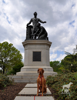
While the Freedmen’s Memorial Monument to Abraham Lincoln (pictured here during the Intrepid Pup’s recent visit) was actually erected in response to Lincoln’s Emancipation Proclamation of 1863, it’s equally relevant to remember it on today’s 150th anniversary of the DC Emancipation. Blocks from the Capitol Building in a park that was once the site of a Civil War hospital, the monument rises, a pedestal topped with a sculpture grouping designed by Thomas Ball (1819-1911). It depicts a newly-emancipated male slave kneeling before Abraham Lincoln. At the base, in capital letters, is the single word: EMANCIPATION. The memorial has been roundly criticized as reinforcing notions of paternalism, supplication and subservience. Indeed, the monument presents an image jarring to 21st-century sensibilities. As a run-up to this year’s 150th anniversary DC Emancipation festivities, the Washington Post just ran an article that included the Freedmen’s Memorial; one reader who’d grown up a stone’s throw from the park responded online, “I never liked that statue. Even as a child, I always thought they should be shaking hands.” But it’s also important to place the memorial within its historical context. As the plaque affixed to the rear of the monument reads:

Freedom’s Memorial
In grateful memory of Abraham Lincoln

This monument was erected by the Western Sanitary Commission of Saint Louis MO:
with funds contributed solely by emancipated citizens of the United States declared free by his proclamation January 1st A.D. 1863.
The first contribution of five dollars was made by Charlotte Scott a freed woman of Virginia being her first earnings in freedom and consecrated by her suggestion and request on the day she heard of President Lincoln’s death to build a monument to his memory.

The monument was dedicated on April 14, 1876, the 11th anniversary of Lincoln’s assassination. Frederick Douglass gave the keynote address before a reported crowd of 25,000. It’s clear from his remarks that he thought of the statue much more as a memorial to Lincoln than as a monument to the act of emancipation, and privately he, too, apparently expressed disappointment at how the figures were portrayed. Then, as now, public art encourages exploration and invites discussion.

Dogging the Details

38°53′23.26″N,  76°59′24.76″W
Freedmen’s Memorial Monument to Abraham Lincoln, Lincoln Park, Washington, DC

wag-a-meter set at 2As noted in an earlier Intrepid Pup posting related to Lincoln Park, the site of this statue is exceptionally dog-friendly (earning it a “2” on the Intrepid Pup Wag-a-Meter), with many people using it as a de facto dog park. It’s important to mention, however, that this is not an officially-designated city dog park. Rather, it’s maintained by the National Park Service, and the expected rules of conduct apply (e.g. keep your dog under your personal control and clean up).

The park is located at 12th Street and Massachusetts Avenue, NE and an easy walk due east from the U.S. Capitol. If arriving by car on a weekday, it’s not difficult to find free 2-hour parking nearby along the residential side streets.

“Knowledge is the Prime Need of the Hour”: Women’s History Month and Mary McLeod Bethune


Mary McLeod Bethune Council House

Every March the United States officially observes Women’s History Month—an outgrowth of both  International Women’s Day and, in 1981, a congressional resolution for a “Women’s History Week.”  In recent years the month has been ascribed a theme, with March 2012’s being “Women’s Education – Women’s Empowerment.”

One who personified this theme through her own works was Mary McLeod Bethune (1875 – 1955), daughter of former slaves, educator, key political influencer, and founder of the National Council of Negro Women (NCNW) in 1935. The Intrepid Pup recently visited two sites, both in the nation’s capital under the aegis of the National Park Service, to learn more.

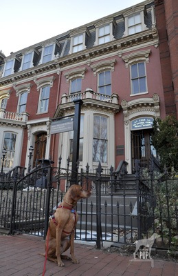
The Mary McLeod Bethune Council House is tucked within a row of stately townhomes in a residential section of northwest Washington off Logan Circle. For the price of $15,500 in 1943, the property became not only Bethune’s residence but also the official headquarters for the NCNW. The site has been administered by the Park Service since 1994. On the day of our visit, we were welcomed by a college undergraduate serving in the Park Service’s Student Career Experience Program. She invited us first to listen to a recording of Bethune speaking at an event in 1955 just a few months prior to her death. Hearing Bethune’s actual voice was a good introduction to someone we previously knew very little about, and it gave us the impression of a strong yet humble woman with a commanding presence. The ranger gave a brief orientation on the highlights of the home’s history, encouraging us to explore the rooms and interpretive displays on the first two floors. She checked on us several times to answer our questions. We had the house to ourselves that weekend afternoon. Just beyond the reach of the tour bus throngs on the National Mall, this historic site is not a high-traffic destination. Yet contributing to its appeal is the very fact that in providing a personal, intimate experience it is in marked contrast with its crowded counterparts. Our knowledge and appreciation of Bethune expanded exponentially as we uncovered details about her upbringing in poverty and perseverance in starting Florida’s Daytona Educational and Industrial Training School for Negro Girls (now Bethune-Cookman University)  in 1904 fueled only by desire and $1.50. It seems fitting that today the university offers a master’s degree program in transformative leadership. It was also fascinating to learn of Bethune’s role in championing African American women’s involvement in the war effort and of her official capacities in the Franklin D. Roosevelt and Harry S. Truman administrations.

Mary McLeod Bethune memorial in Lincoln Park

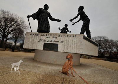
About a mile and half away from the Council House as the crow flies is Bethune in monumental form. Sculpted in bronze by New York artist Robert Berks (1922-2011), the statue grouping emphasizes Bethune as educator, literally and figuratively imparting her legacies to a boy and girl. Around the base are inscribed excerpts from her last will and testament which Bethune also holds in her outstretched left hand. The oft-repeated refrain “I leave you…” is completed by such powerful concepts as “hope”, “a thirst for education,” and “racial dignity.” The monument itself has an interesting history. It’s located in Lincoln Park 11 blocks due east of the U. S. Capitol Building. Book-ending the rectangular plot of open space maintained by the Park Service are the Bethune memorial and, sited directly opposite, the famous Freedmen’s Memorial Monument to Abraham Lincoln (also known as the “Emancipation Grouping”) which was paid for entirely by freed slaves and sculpted by Thomas Ball in 1875.  The original intent had been for the dedication of a Bethune memorial to coincide with the 100th anniversary of Lincoln’s Emancipation Proclamation in 1963, but the entire project was delayed. With funding from the NCNW, the Bethune monument was ultimately unveiled in 1974 on what would have been Bethune’s 99th birthday. Adding the Bethune memorial to the park also resulted in turning the Freedman’s Memorial 180 degrees so the two groupings would face each other.

If the Bethune memorial’s roughly faceted, somewhat abstract style looks familiar, it’s because Robert Berks sculpted several high-profile pieces. In DC alone, one can most readily see other examples of his handiwork in the 22-foot seated Albert Einstein memorial (1979) outside the National Academy of Sciences and in the 8-foot, 3000-pound bronze bust of John F. Kennedy (1971) gracing the Grand Foyer of The John F. Kennedy Center for the Performing Arts. In a city dotted with literally hundreds of statues, monuments, and memorials, Berks’ Bethune sculpture represented the first honoring a woman (let alone an African American woman) installed on public park land in the nation’s capital.

Dogging the Details

38°54′29.31″N,  77° 1′50.29″W
Mary McLeod Bethune Council House, Washington, DC

38°53′23.19″N,  76°59′21.13″W
Mary McLeod Bethune Memorial, Lincoln Park, Washington, DC

wag-a-meter set at 2There is no fee charged to explore the Bethune Council House. While dogs understandably aren’t allowed inside, the neighborhood itself has sidewalks and is great for dog-walking.

Lincoln Park is exceptionally dog-friendly and what earns this Bethune-themed expedition a “2” on the Wag-a-meter.  In fact, the park’s entire center concourse is basically one big unfenced and very popular dog run. So long as your dog plays well with others, it’s among the top spots to rub noses with the canine denizens of Capitol Hill. During our visit,  Tavish encountered 3 weimaraners, a doberman, a rottweiler, a basset hound, a Wheaton terrier, a miniature greyhound, a Boston terrier, and a shepherd mix.

Important to note is that Lincoln Park is not an officially-designated city dog park. There are trash cans, but bring your own your poly bags to clean up after your dog.