A Tail at Three Sites

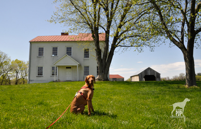
Tavish at Best Farm, Monocacy National Battlefield

Tavish at Best Farm, Monocacy National Battlefield

Many are the lessons that can be learned from historical sites, and a visit to Maryland’s Monocacy National Battlefield a few weeks ago was no exception. For Tavish the Intrepid Pup, the teachable moment came from a “stimulating” encounter snuffling the grass around a low-voltage electric fence by the cow pasture at the Worthington Farm site. (Note: no worries, he’s fine…just a lot more observant now when it comes to fences.) For Team Tavish, it was the realization that were it not for what happened at Monocacy back on July 9, 1864, the Civil War might have taken a different turn.

The battle at Monocacy represented the third and final Confederate invasion of the North. It often doesn’t get its due in history books because of the more epic scale of the previous two invasions at Antietam (1862) and Gettysburg (1863). But Monocacy is intriguing in its own right. With great irony, it was the Union army loss of the battle that actually saved the nation’s capital a mere 47 miles away. There are far greater chroniclers of Civil War battle strategy than the Intrepid Pup, but the basic storyline of Monocacy is this:  Ulysses S. Grant was beginning to successfully deter Robert E. Lee’s Confederate forces in the east. To sustain the pressure on those forces, Lt. General Grant was diverting to Richmond fresh reinforcements in the form of seasoned troops from the various forts that protected Washington, D.C. With relatively few soldiers left behind to “mind the store” so to speak, Lee recognized an opportunity and tasked Lt. General Jubal Early (1816-1894) with making a relatively quick run north up the Blue Ridge to cross at Harper’s Ferry and then invade the capital from the northwest. Early and his men very nearly succeeded except for  intervention from an unlikely source: John Garrett. Personally, Garrett was a Confederate sympathizer. Professionally, however, Garrett was the president of the Baltimore and Ohio (B&O) Railroad with many of his clients and much of his business centered in Union territory. It was he who alerted Major General Lew Wallace, stationed in Baltimore, to Early’s troop movements. Wallace had precious little time to react and even fewer resources to muster, but with an inexperienced band of 2,800 short-term recruits (i.e. not battle trained), he set out to intercede Early. The good news for Wallace was that by the time he encountered Early’s Confederate forces at Monocacy on July 9, his Union ranks had swelled to 5,800. The bad news for Wallace was that he was still outnumbered three to one. Imagine going into battle with full knowledge that the odds are squarely not in your favor.

The battle played out over about 12 hours amid several farmers’ fields and along a rail bed and the banks of the Monocacy River…you can still “read” the battle in the landscape today. By almost any measure, Wallace had been defeated and had lost nearly a quarter of his men in the process. Yet Early hadn’t expected to meet such resistance at Monocacy, and the fighting cost him some 900 men and critical hours. With no choice but to encamp on the battlefield the night of July 9, Early had effectively lost a day—and the element of surprise—in an already tight timeline. Early’s men pushed onward the next morning and reached the northwest boundary of Washington by the following afternoon to mount an attack on Fort Stevens. The delay, however, had given Grant just enough time to send steamships full of soldiers to repopulate the defensive forts around Washington. So, while the fighting at Fort Stevens on July 11 was fierce and deadly, it was not enough to fully infiltrate the nation’s capital. Early withdrew, ultimately unsuccessful in his mission.

Tavish at Fort Stevens

Tavish at Fort Stevens. President Abraham Lincoln went to witness the fighting here on July 11, 1864. Confederate sharpshooters aimed for him, making Lincoln the only U.S. President to come under direct enemy fire in time of war.
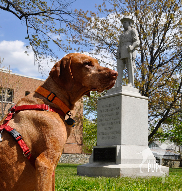
Tavish at Battleground National Cemetery

Tavish at Battleground National Cemetery

Fifty nine Union soldiers lost their lives in the Battle of Fort Stevens—the only Civil War battle to be waged in the District of Columbia—and 41 were buried the evening of July 12 at a site a half mile north of the fort on the battleground itself. President Lincoln attended the interment ceremony and consecrated the land as hallowed ground. Now known as Battleground National Cemetery, this tiny plot of land on Georgia Avenue, N.W. between Van Buren Street and Whittier Place is among America’s smallest national cemeteries. Added over the years were various monuments commemorating the regiments that fought, as well as several plaques bearing such sentiments as: “The muffled drums’ sad roll has beat the soldier’s last tattoo. No more on life’s parade shall meet that brave and fallen few.” There’s also a stone superintendent’s house designed by General Montgomery Meigs (1816-1892), a veteran of the Battle of Fort Stevens and also the architect/engineer of DC’s Pension Building that today houses the National Building Museum.

And what ever happened to Major General Wallace (1827-1905)? Yes, he lost the battle but survived the war and, interestingly enough, went on to write the famous novel Ben-Hur: A Life of the Christ (1880). His book was subsequently adapted for the silver screen several times, with the most notable version being the 1959 film classic (starring Charlton Heston and his famous chariot race scene) that reaped 11 Academy Awards.

Dogging the Details

Click to see what 2 on the Wag-A-Meter means39°22′37.90″N, 77°23′43.34″W
Monocacy National Battlefield
, Frederick, Maryland

38°57′52.05″N, 77°1′44.67″W
Fort  Stevens, Washington, DC

38°58′14.69″N, 77° 1′37.23″W
Battleground National Cemetery, Washington, DC

Monocacy NB

Tavish among the bluebells on the Ford Loop Trail, Monocacy National Battlefield

Because of the three sites’ relatively close proximity to one another, tracing the full story of Monocacy—from the initial battle in Frederick, Maryland, to the conclusion at the tiny cemetery in Washington—is easy to experience in one very full day or over the course of two  leisurely days. There’s the most ground to cover at Monocacy National Battlefield. Begin your foray at the visitors’ center on Urbana Pike. It used to be in smaller quarters at the Gambrill Mill site but moved to this nice new building about five years ago. Although dogs aren’t allowed inside the visitor center, make sure you head upstairs. There’s a succinct yet exceptionally comprehensive exhibition with an overhead timeline, lighted battle map, and several interactives that really help put what you’re about to see outside in a broader context. Be sure to pick up a brochure from the ranger, because it contains not only driving directions but also a trail map. There are 5 separate locations within the national park to get out explore with your dog. As always, dogs are to be leashed and picked up after:

  • While Best Farm and Monocacy Junction don’t have any trailheads per se, there’s plenty of room to explore the immediate vicinities from the parking areas. Best Farm is also associated with a remarkable 1862 event related to Antietam (Learn more at the visitors’ center or Google “Lee’s Lost Orders”!).
  • During the battle, the Gambrill Mill site was co-opted as a Union field hospital, and the short loop trail here includes a boardwalk section leading to the Monocacy River. Tavish enjoyed wading in the shallows.
  • The Thomas Farm site contains two loop trails that wind through the farm fields that withstood the heaviest fighting that day in 1864.
  • Worthington Farm has the longest trails, though neither of the two loops takes more than a half hour to hike. We went on a Sunday afternoon and had the place mostly to ourselves save for a couple joggers. The Ford Loop Trail is flat and hugs the flood plain of the Monocacy River. Should you happen to time it right in the springtime, as we did by happy coincidence, you’ll find the path to be spectacularly carpeted with Virginia bluebells (see photo). Much of the Brooks Hill Loop Trail borders the aforementioned cow pasture. Fresh from his fence episode, Tavish curiously appraised the gangly calves and their moms from a respectful distance. Once the trail enters woodland it quickly gains elevation, topping out on a ridge with an expansive view across emerald farmland toward Thomas Farm.

Back in the District of Columbia, visiting Fort Stevens simply involves snagging a parking spot on the street or in the neighboring church parking lot. All that remains of the once extensive Civil War Defenses of Washington are more than 20 locations throughout DC-MD-VA ranging from simple forest sites to earthworks to full-fledged forts. Fort Stevens is not staffed but does have a couple interpretive panels to orient visitors to the partial reconstruction. Continue the short distance to conclude your journey by parallel parking on Georgia Avenue in front of Battleground National Cemetery.

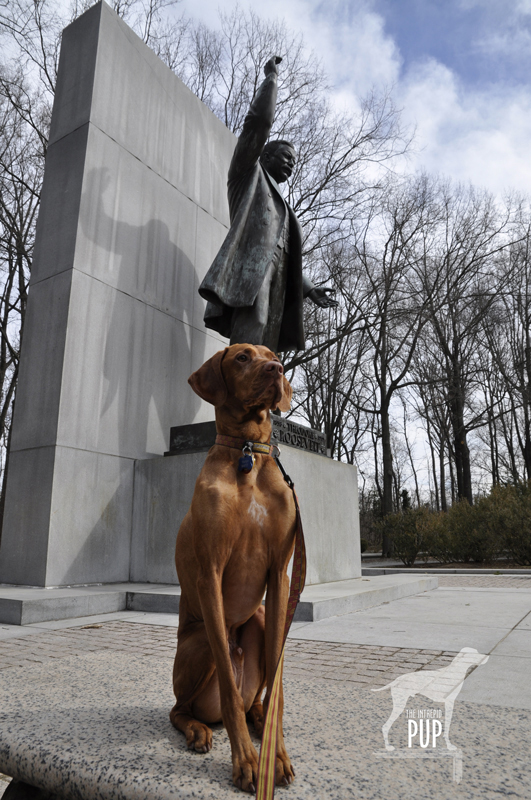
Thanks, Teddy!

Tavish at Roosevelt Island If you’re as big a fan of America’s national parks as Tavish the Intrepid Pup, then National Park Week is like having Christmas, a birthday, and the 4th of July all rolled into one. In 2012 National Park Week runs from April 21 through April 29. Jointly promoted by the National Park Service (NPS) and the National Park Foundation—the parks’ official charity—National Park Week collectively celebrates the 84 million acres preserved as “America’s best idea” by offering free admission to all 397 national park sites throughout the country. To be fair, more than 250 of these are free year-round, but in going fee free system-wide for a week, cost simply can’t be an excuse for not visiting a national park. So, in the spirit of Intrepid Pup:  “Come! Adventures Await.”©

Throughout the week, Intrepid Pup will highlight various NPS sites he’s visited recently, so check back often! In the meantime, we’re starting with the Theodore Roosevelt Island National Memorial because, seriously, where better to step off National Park Week than the place dedicated to the guy who first made the environment and national parks central to domestic policy?

Theodore Roosevelt (1858-1919) became the the youngest man to ascend to the U.S. presidency, taking over when President McKinley’s term ended prematurely with an assassin’s bullet. While Roosevelt can’t lay claim to designating Yellowstone the country’s first national park (President Grant had that honor in 1872) or even to establishing the National Park Service (President Wilson got the credit in 1916), he arguably did more to shape the tenor of American resource conservation than any president before or since. During Roosevelt’s 1901-1909 tenure as the 26th president of the United States, he created five national parks and established the U.S. Forest Service. With the passage of the 1906 Antiquities Act he provided the precedent and legislative vehicle for presidents to protect historically significant sites as National Monuments…of which he then personally authorized 18. All told, among national forests, parks, game preserves, bird reservations and national monuments Roosevelt amassed a legacy of preserving a staggering 230 million acres of public land.

To visit Roosevelt Island today is to step onto a sylvan oasis. Wedged between Virginia and the District of Columbia’s banks of the Potomac River, this 88-acre dollop has had a schizophrenic past:  Inhabited by 16th-century Native Americans. Overtaken by various colonials in the 18th century. Owned by George Mason (author of the Virginia Declaration of Rights) and later by his son in the early 19th century for entertaining high society in a summer house built upon its ridge. Utilized by the 1st U.S. Colored Troops as a Civil War mustering ground in 1863. Cherished as a safe haven for escaped and freed slaves fleeing the South between May 1864 and June 1865.

The Roosevelt connection didn’t come until the 1930s, when the Theodore Roosevelt Association acquired the island and promptly transferred title to the National Park Service. Initial efforts to create the only capital-area memorial to Roosevelt involved the Civilian Conservation Corps removing invasive vegetation and planting nearly 20,000 native trees. Frederick Law Olmsted Jr. (1870-1957) was enlisted to come up with an overall design. Various issues hampered progress, including World War II, and the project wasn’t resumed until the 1960s. Though Olmsted had passed away in the intervening years, many of his original ideas like a Memorial Plaza and foot trails survived the final plan put forth by Eric Gugler (1889-1974). Paul Manship (1885-1966)—perhaps better remembered for his Prometheus Fountain in New York City’s Rockefeller Center—designed the 17-foot bronze statue of Roosevelt ultimately dedicated on the site in 1967.

In Tavish’s visits to the island, we invariably begin at the expansive Memorial Plaza where Roosevelt stands at the far end, backed by a 30-foot granite shaft, right arm raised above his head as if he were in the midst of an animated speech. Four 21-foot granite tablets bear Roosevelt quotations under the headings of Nature,  Manhood, Youth, and The State. Three trails (Swamp, Woods, and Upland) radiate from the plaza; none are longer than 1.3 miles. Except for a traffic helicopter’s shadow raking through the tree canopy or the dull roar of a Dc-9 following the river southward on its final approach to Ronald Reagan-Washington National Airport, you’d never believe you’re so close to the city. Don’t go expecting dazzling waterfront views; for most of the year, heavy foliage occludes shoreline panoramas of the Kennedy Center, the Watergate and Georgetown. The Potomac River is tidal but it’s fresh water that infiltrates the marshland skirting the Swamp Trail’s boardwalk. On our most recent jaunt yesterday, yellow irises were in bloom. Low tide had temporarily marooned minnows in the shallows. We spotted numerous marsh birds and encountered three deer grazing on green tendrils mere feet from the boardwalk. Two salamanders basking in the sun skittered away when we approached.

Roosevelt Island is one of five NPS sites—if you don’t count his visage on Mount Rushmore—specifically honoring our 26th President. (Intrepid Pup bonus points if you can name the others! Answers are below.*) In hiking the island,  Roosevelt’s foresight for preserving parkland is readily appreciated. As one of his quotations chiseled in the nearby stone states:

“The nation behaves well if it treats the natural resources as assets
which it must turn over to the next generation increased and not impaired in value.”

Thanks, Teddy!

Dogging the Details

38°53′50.70″N, 77°3′50.22″W
 Theodore Roosevelt Island National Memorial, Virginia

Click to see what a "1" on the Wag-a-meter means By car, one can only reach the parking lot for Roosevelt Island from the northbound lanes of the George Washington Memorial Parkway. The  lot serves as a trailhead for runners and cyclists on more far-flung journeys along the Mount Vernon and Potomac Heritage Trails. Though most who park here likely never cross the pedestrian bridge onto the island, the grounds nonetheless attract a fair share of walkers and joggers. Dogs are permitted on the island but must be on a 6-foot leash at all times. As always, pick up after your dog. Trash receptacles are understandably sparse along the island’s trails but are abundant in the parking area.

Be aware that low-lying areas of the island flood easily, and sections of trail are seasonally boggy or otherwise closed. Consult the bulletin board on the island side of the pedestrian bridge for current trail info.  Bear right and make the first left uphill to view the Memorial Plaza; otherwise stay right to embark on the Swamp Trail that encircles the island. The Island scores a “1” on the Intrepid Pup Wag-a-Meter for its easy hiking.

*The other four Roosevelt-related NPS sites are Roosevelt National Park (North Dakota), the Roosevelt Birthplace National Historic Site (New York City), Sagamore Hill National Historic Site (Oyster Bay, NY), and the Roosevelt Inaugural National Historic Site (Buffalo, NY).

A Blossoming Tradition

100th anniversary cherry blossoms

Think spring in Washington, DC and it’s synonymous with cherry blossoms. For a fleeting few days the frothy, confectionery splendor of more than 3,700 blooming cherry trees transforms the already-stunning National Mall and Memorial Parks. What makes 2012’s vernal display all the more special is that it marks the centennial of the gift of 3,020 trees from Japan. With this 100th anniversary comes an unprecedented five weeks (March 20 – April 27, 2012) of celebratory events throughout the city, ranging from concerts, special exhibitions, and performances highlighting Japanese culture, to fireworks, a kite festival, and the annual parade. The Cherry Blossom Festival, which has been an annual event in some form since 1935, today partners with the National Park Service, which in turn is offering its own activities and special ranger talks from March 24 – April 15, 2012.

The trees themselves are likely among the most scrutinized and closely monitored in the country. Tracking green buds, florets, and peduncle elongation, the National Park Service keeps meticulous data on the five stages of blossom development. While there are multiple types of cherry trees in the park, the most prevalent is the Yoshino, so the Park Service defines peak bloom as specifically being “when 70% of the blossoms of the Yoshino Cherry trees are open.” The historical average predicts the peak bloom date to be April 4th, but Mother Nature is notoriously fickle. A cold snap or a warm spell can move that date significantly in either direction, and once the blossoms are out, all it takes is one good gusty thunderstorm to toss all the pink petals from the trees.

Seeing the blossoms with the Intrepid Pup has become an annual tradition, but getting to the trees can be an adventure unto itself. The Metrorail system or biking are by far the best bets, but if you’re bringing your dog along, you’ll have to find an alternate means of transportation. Parking anywhere close to the Tidal Basin during the peak of the blossoms is a fantasy, so consider parking further away and walking back. Pedicabs seem to be a viable option, as we saw a lady and her pug zip by in one on our own most recent walk en route to the blossoms.

Bear in mind that while the outdoor venues of the National Mall and Memorial Parks are dog-friendly, you must keep your dog leashed at all times and prevent your dog from entering the Tidal Basin waters or any of the pools or fountains. As a general rule, dogs are not allowed in the inner sanctum (i.e. where the statue is) of any memorial, but Team Tavish has found that simply asking a park ranger for clarification on the boundaries is both appreciated and avoids any unnecessary confusion. And, as it turns out, many of the rangers really like dogs. The ranger we met at the Jefferson Memorial last week has been with the National Park Service for more than 20 years and was genuinely pleased to see us out exploring the monuments and blossoms with Tavish. Though the ranger regretted that she couldn’t permit him past the exterior columns on the façade, she went out of her way to give the Intrepid Pup a commemorative 100th anniversary cherry blossom pin bearing Paddles the beaver, a Park Service cartoony “mascot” that otherwise cautions visitors not to pick the blossoms. Opportunistic beavers have long tried to gnaw on the cherry tree trunks, but the ranger confided that the mesh barriers one sees around the cherry trees are good deterrents and that she had seen more raccoons and foxes than beavers so far this spring.

Dogging the Details

38°53′06.39″ N, 77°02′11.27″ W
National Cherry Blossom Festival, Washington, DC

Click to see what 2 on the Wag-A-Meter meansAs mentioned above, if you don’t already live in the DC area, timing your visit to see the blossoms at their peak can be an inexact science. And be prepared to do miles of walking to fully appreciate them. For these reasons, the festival gets a “2” on the Wag-a-meter.

The Yoshino cherry trees concentrated around the Tidal Basin seem to attract the greatest flocks of blossom-gazers, and the narrow 2.1-mile walkway encircling the water’s edge can become quite congested. If you or your dog aren’t fond of pedestrian traffic jams, you have a couple of choices. Either plan your walk for the early to mid morning or late afternoon hours on a weekday (the lunch hour and nice weekends bring out tourists and locals) or stray off the well-beaten path. The Washington Monument grounds are much more open, absorb a lot of people, and boast numerous cherry trees representing yet another gift from Japan, this one to Lady Bird Johnson in 1965. Or, just a short distance east of the Jefferson Memorial you’ll find access to Ohio Drive, SW. This road and adjacent sidewalk loop 4.1 miles around East Potomac Park and Hains Point, and the whole way is lined with cherry trees! While your vistas from here won’t be of the monuments, you will have lovely views of the Washington Channel and the Virginia banks of the Potomac River. It’s on this route that you’ll discover completely different species of cherry trees: Kwanzan, Japanese weeping cherries, Takesimensis, Yama-zakura, and a single Okame cherry tree. There’s also an interesting grove of cherry trees on the golf course—land once a research area for the U. S. Department of Agriculture (USDA)—that likely represent the oldest anywhere in the park. Although 1912 is commonly cited as the year of the gift of the celebrated trees, Japan actually first sent 2,000 trees to Washington two years earlier in 1910. Sadly, those trees arrived with infestations, and after unsuccessful treatments, President Taft—at the recommendation of the USDA—ordered that they all be burned. It appears, however, that the precious few in this outcropping miraculously survived.

Finally, be sure to bring a camera. Pale pink cherry blossoms against granite memorials and a clear blue sky ought to be on your “bucket list” of backdrops for great family photographs.


Getting Out and About in Vacationland

Just learned about the inaugural Great Maine Outdoor Weekend taking place this March 2-4, 2012. It’s being touted as a bi-annual celebration with a “series of events scheduled all across the great state of Maine to help connect [people] with the natural world, and promote fun, physical activity, and good health.”

Well, if that isn’t something that appeals to the Intrepid Pup’s sensibilities, we don’t know what will! Tavish isn’t in Maine this weekend to help celebrate, but he did spend the first 5½ years of his life in “Vacationland” living the state’s motto “Maine: The Way Life Should Be.” And in that time, he had ample opportunity to sample and enjoy some of the best trails, views and natural beauty the state has to offer. So, while this is by no means a comprehensive list, here are some of the Intrepid Pup’s top picks, by region, for getting out and about with your dog in Vacationland:

Dogging the Details

wag-a-meter set at 2

The three excursions described below all rank “2” on the Wag-a-meter as these are active, outdoor adventures with some pre-planning required. You’ll also be out-and-about pretty much the whole day with your dog, so be sure to pack along food/treats, water, and doggie bags.


MAINE BEACHES

43°20′51.32″ N, 70°28′50.92″ W
Kennebunk Beach, Kennebunk, Maine

Kennebunk BeachIf you’ve always associated Maine with craggy shorelines, there are plenty. But you might be surprised to learn that beautiful sandy beaches can be found in coastal towns throughout southern Maine. One favorite is Kennebunk Beach. At low tide, this crescent-shaped swath of sand extends out about a hundred yards before receding into the Atlantic Ocean. Then, if you could even see this far, the next land you’d spot would be Portugal. Seriously. The surrounding communities, collectively known as the Kennebunks, are tourist magnets (particularly in the summer and fall), but Kennebunk Beach holds a year-round allure even after temperatures for swimming and sun-bathing are but distant memories. The sidewalk follows the shoreline and is great for dog-walking, complete with several waste receptacles and doggie-bag dispensers. In fact, this same scenic route along the seawall is used by the area’s Animal Welfare Society for its insanely popular (and fun) annual “Strut Your Mutt” fundraiser.
Within certain hours, dogs are allowed ON the beach, too, provided you follow the regulations. Kennebunk Beach is a great spot for your dog to run, swim, and enjoy the company of the myriad other dogs and dog owners you’ll find. Do note that in the summer, nearby parking requires a beach permit.

Want to spend a full day exploring the Kennebunks with your dog? If it’s between June 15 and the day after Labor Day, time your romp on Kennebunk Beach to be either before 9 AM or after 5 PM. For the rest of the day, consider heading to Kennebunk’s very own dog park just a short drive from the beach up Sea Road. This fenced-in dog park shares an entrance with Kennebunk’s recycling center and is open daily from dawn to dusk. Still have energy to burn? From the dog park, go across Sea Road into the parking lot for Sea Road School. On the left-hand side, you’ll be able to access the trailhead for the Bridle Path, going southeast. Since it’s the former rail bed for the Boston & Maine Railroad from 1883, it’s pretty flat. For a little ways you’ll snake behind neighborhoods, but before long, you’re surrounded by woods and marshland. Keep your eyes peeled for glimpses of the Mousam River to the west; it’s a favorite for birders and kayakers. In this direction, the trail ends in about 2 miles at the junction with Western Avenue. Reward yourself and your dog for a day well-spent by heading into the heart of nearby Kennebunkport. In the heart of Dock Square, you’ll find Scalawags, a marvelous pet boutique, where a bowl of fresh water always awaits. Owner Mary Beth does a great job of sourcing tasty dog treats and an array of truly unique Maine-made and Maine-inspired wares (think rope leashes hand-crafted by Maine lobstermen!) for your four-legged friends. Extending your stay is always an option, and you’re in luck in that the Kennebunks are home to a number of pet-friendly accommodations like the Captain Jefferds Inn, the Colony Hotel, and the Hounds Tooth Inn.


GREATER PORTLAND AND CASCO BAY

43°39′02.59″ N, 70°11′41.37″ W
Peaks Island, Maine

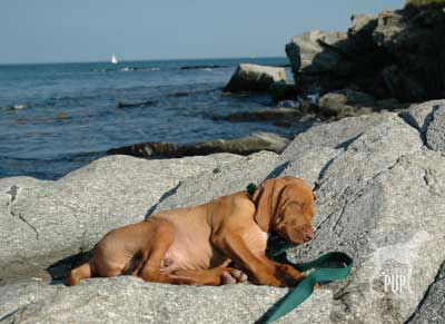
Peaks IslandTeam Tavish dug back into the Intrepid Pup archives for this pic of an approximately 11-week-old Tavish on one of his very first trips to what would become a frequent destination: Peaks Island. Of the several hundred island communities that dot Casco Bay, Peaks is the most populous with ~1,100 year-round residents, though that number swells to 4,000+ during the summer months. Peaks is actually part of the City of Portland, but its history has been punctuated by various—and as yet, unsuccessful—secessionist movements. It’s accessible via a 15-minute ride from downtown Portland on the Casco Bay Lines ferry and is thus a popular day-trip destination. Vehicle traffic is minimal, with bicycles and golf-carts easily outnumbering cars on the roads. At just 2 miles long and about a mile wide, Peaks is both walkable and eminently picturesque.
Dogs are allowed on the ferry but do need their own tickets. Climb aboard and take a seat on the open-air top deck. It’s not uncommon to spot harbor seals en route. Once you arrive at the ferry landing on Peaks, walk up the ramp to Downfront, where you can fortify yourself with an ice cream cone. As you head out the door, hook a right to stay on  Island Avenue and go back past the ferry landing, a little park, and a few restaurants. Within about 1/4 mile, the road will curve inland. Make a right on Whitehead and look for the short walking trail that leads down to Picnic Point and Hadlock Cove, where this photo of Tavish was taken. Here’s your craggy coastline and a stunning view of Casco Bay! If you bring along a picnic and a camera and never get any further in exploring Peaks, you won’t be disappointed. There is, however, much more to see. For a longer walk, rejoin the main road heading east, and within a few hundred feet you’ll come upon the Fifth Maine Museum. Its Memorial Hall cottage was constructed in 1888 as a memorial and reunion site for members of the Fifth Regiment Maine Volunteer Infantry (1861-1864) active during the Civil War. The museum’s exhibitions and programming cover regimental history and, more broadly, various facets of the island’s settlement. The museum is also playing a key role in the statewide sesquicentennial commemoration of Maine’s role in the Civil War. Heading right (east) from the Fifth Maine Museum, Seashore Avenue passes the 8th Maine Regiment building (now a lodge) and then quickly opens onto panoramic shoreline vistas. Seashore Avenue makes a circuit of the island and winds up being a little more than a 3-mile walk, ultimately reconnecting to Island Avenue, delivering you past the quirky, seasonally-open Umbrella Cover Museum and right back to where you started at the ferry landing. You can trim your overall distance by turning off Seashore Avenue onto any of the roads that bisect the island (see map). If you have time to spare before catching your return ferry, enjoy Shipyard Brewing Company beverages and a meal at the Inn on Peaks. When outdoor seating is available, your dog can join you on the patio.

MIDCOAST

44°13′22.91″ N, 69°04′07.73″ W
Mount Battie, Camden Hills State Park, Camden, Maine

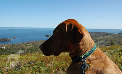
Mount BattieCamden, Maine is a charming Midcoast town with quaint shops and inns, great seafood, schooner charters, and a bustling autumn Windjammer Festival that spotlights Camden’s picturesque marina. It’s also great base from which to undertake some hiking. Just over a mile outside the town center, heading north on Belfast Road/Route 1, is the main entrance on the left to Camden Hills State Park. The 30+ miles of trails are well-maintained and well-marked, but they do intersect one another frequently within the park’s 5,700 acres, so it helps to request a map at the ranger station and have a ranger suggest an appropriate route, based upon the time you have available.

A favorite of Team Tavish is the Mount Battie Trail, which is accessed from the parking area just beyond the ranger station. While the trail isn’t technically challenging (heck, it even crisscrosses the auto road to the summit, but driving up would be “cheating”!), it’s a lovely couple miles of walking in the woods, and the payoff is huge. The trail tops out at a smooth rock outcropping 780′ above sea level with a breath-taking view of Camden Harbor immediately below and Penobscot Bay beyond. In autumn, leaf-peeping and spotting the migrating hawks are additional draws. For a longer foray, daisy-chain the trails and try out Bald Mountain (1200′), Mount Megunticook (1385′), or Maiden Cliff (800′).

Word has it that the next Great Maine Outdoor Weekend is already slated for September 28-30, 2012.  Stay tuned for the Intrepid Pup to share more of his favorite Maine excursions then!