Gettysburg: Intrepid Pup Ventures to Hallowed Ground

Gettysburg_collage

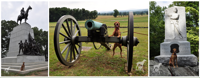
Gettysburg’s hallowed ground. At left: the Virginia Memorial overlooks the field where Pickett’s Charge took place and General Lee lost more than 5,000 men in a single hour. Center: Cannon dot the fields along West Confederate Avenue, near the Observation Tower. At right: A memorial to the 5th Michigan Infantry in the Rose Woods.

Seven score and ten years ago, there was Gettysburg. Or, more to the point, the Battle of Gettysburg, the “High Water Mark” of the Civil War and its most devastating battle. The first three days of July 1863 turned Pennsylvania farmland into a blighted battlefield, claiming some 51,000 casualties and 3,000 horses. It’s a battle rightly memorialized—its tactics, weather, and personalities endlessly scrutinized.

Team Tavish’s visit to Gettysburg came about after spending the better part of a day hiking the trails at Maryland’s Catoctin Mountain Park (see blog post).  In consulting a map, Gettysburg looked to be close by, just across the Mason-Dixon line (and the Maryland-Pennsylvania border).  Before heading on, though, we consulted with a local just to be sure. Even as she confirmed that it’d indeed be a short trip, she began shaking her head. “You know, we used to take our horses out to ride the bridle trails at Gettysburg,” she said, her face clouding. “But those horses spooked every damn time. And if you were riding by yourself? Forget it. It’s like they knew.”
Gettysburg_20thMaine

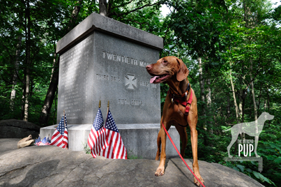
Tavish traced the footsteps of fellow Mainers en route to Little Round Top and this memorial commemorating the role of the 20th Maine Volunteer Infantry Regiment.

So with that little sense of foreboding, we drove up the road to Gettysburg, covering in a half hour a distance we knew would’ve taken Civil War troops infinitely longer.

With a late afternoon arrival and a lot of hiking already under our belts, we opted to experience Gettysburg this time around via the 24-mile auto road.  A map obtained from the Visitor Center guided our way, and the sixteen stops provided ample opportunity to get out and explore. Cannon, historical markers, and memorials are at every vista. It seemed fitting for Tavish as a native Mainer to check out the memorial at Little Round Top dedicated to the 20th Maine Volunteer Infantry Regiment. As we traversed the path through the copse to the monument, the stillness was in marked contrast to the bedlam of July 1863. There, on the battle’s second day, Colonel Joshua Chamberlain and his Maine volunteers were charged with holding the beleaguered Union line at all costs. . . which ultimately translated to a bayonet attack and fighting at close range. The line held, and for his leadership that day, Chamberlain was awarded the Medal of Honor. Chamberlain would also go on to personally see the Civil War through to its conclusion at Appomattox Court House, Virginia, in 1865; General Grant asked Chamberlain to command the Union troops overseeing the surrender of weapons and colors by General Lee’s infantry. Notably, Chamberlain ordered his men to silently salute the Confederates as they passed. Chamberlain remains one of Maine’s most beloved native sons—for his battlefield valor as well as his post-war contributions as Maine governor and president of Bowdoin College. Chamberlain’s house remains open to the public and is interpreted as part of the Pejepscot Historical Society in Brunswick, Maine.
Gettysburg_wolfhound

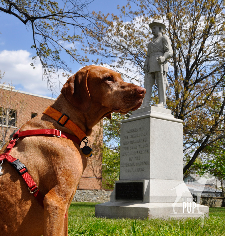
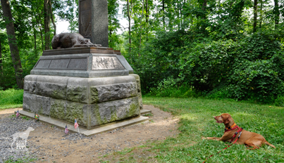
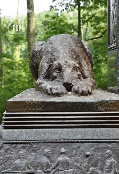
Tavish meets the gaze of the wolfhound at the memorial to the Irish Brigade in the Rose Woods.

Our last task at Gettysburg was to locate the monument for the three New York regiments of the Irish Brigade.  The narrow approach skirts The Wheatfield—where fierce fighting killed and wounded more than 4,000 men—and then snakes into the Rose Woods.  Despite all the tourists at Gettysburg  on the afternoon of our visit, we were strangely alone when we came to Sickles Road. Dappled sunlight streamed through the trees, and it was here more than anywhere else that day that it wasn’t a stretch to imagine spooked horses. On the left of the roadside, a Celtic cross reaches some 19 feet skyward. Crouched in perpetuity at its base, head resting between outstretched paws, is a lone Irish wolfhound sculpted by William Rudolf O’Donovan, a veteran of Gettysburg.  The noble hound is meant to signify the fidelity of the Irish Americans who fought for the Union. The Irish Brigade had already suffered heavy losses in the war and on the evening of July 2, 1863, added another 76 to its grim tally of wounded, missing, and dead.
Gettysburg_IrishBrigade

The solemn stare of Gettysburg’s Irish wolfhound.

While the wolfhound on the Irish Brigade memorial is symbolic, many actual dogs have been documented in the annals of Civil War history. Some were adopted as unofficial regimental mascots,  others followed their masters to war, and still others were strays seeking human companionship in the encampments in the wake of the conflict.

Gettysburg demonstrates the power of place, and reminds us still—in the words of President Lincoln—”that from these honored dead we take increased devotion to that cause for which they gave the last full measure of devotion….”
 

Click to see what 2 on the Wag-A-Meter meansDogging the Details

39°48′40.08″N,  77°13′31.50″W
Gettysburg National Military Park, Gettysburg, Pennsylvania

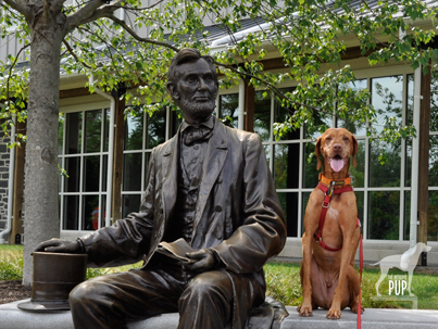
Gettysburg earns a “2” on the Intrepid Pup wag-a-meter for the many ways in which one can experience the military park and its canine connections. Make like the Intrepid Pup, and embark upon your time at Gettysburg with a stop at the national park’s Visitor Center.  An outdoor sculpture of Abraham Lincoln (see below) provides a good photo op. Once oriented, you can set out by bike, via hiking trails, with a licensed battlefield guide, or on a self-guided auto tour.
Gettysburg_Lincoln

Penny for your thoughts? Tavish and President Lincoln sit for a spell at Gettysburg’s Visitor Center.

Leashed dogs are permitted on trails and grounds throughout Gettysburg National Military Park. Be sure to bring ample water for yourself and your dog; it can get pretty toasty on the battlefield, especially during the summer months. As always, be sure to clean up after your dog.

Pets are not allowed in the Visitor Center itself or at Soldiers’ National Cemetery where Lincoln delivered his now-famous Gettysburg Address on November 19, 1863—a little more than four months removed from the battle. To fully appreciate the extensive interpretive offerings at these two venues, you’ll need to return on your own.

One final note:  unlike Tavish—who unfortunately missed seeing this on his visit—you’ll want to be sure to seek out the monument to the 11th Pennsylvania Volunteer Infantry Regiment, located on Doubleday Avenue in the northwest corner of the park.  At its base lies a bronze replica of the regiment’s scrappy mascot, a bull terrier named Sallie. She was present at Gettysburg and had become separated from her regiment during the turmoil. Soldiers later located her at the day’s original battle line, where she was keeping vigil over the wounded and the dead. Sallie’s heroics were well documented throughout the Civil War. She had participated in the battles at Antietam, Fredericksburg, and Chancellorsville; purportedly received a tip of the hat from President Lincoln during a review of the troops earlier in 1863; and was subsequently wounded at Spotsylvania. Sallie died of a gunshot wound in 1865 during the Siege of Petersburg. Her comrades buried her on the battlefield.

A Tail at Three Sites

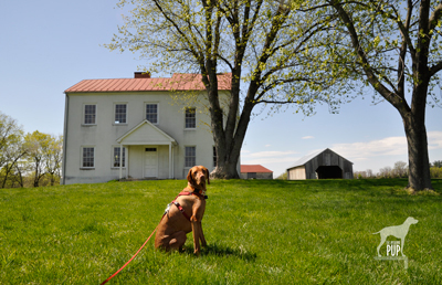
Tavish at Best Farm, Monocacy National Battlefield

Tavish at Best Farm, Monocacy National Battlefield

Many are the lessons that can be learned from historical sites, and a visit to Maryland’s Monocacy National Battlefield a few weeks ago was no exception. For Tavish the Intrepid Pup, the teachable moment came from a “stimulating” encounter snuffling the grass around a low-voltage electric fence by the cow pasture at the Worthington Farm site. (Note: no worries, he’s fine…just a lot more observant now when it comes to fences.) For Team Tavish, it was the realization that were it not for what happened at Monocacy back on July 9, 1864, the Civil War might have taken a different turn.

The battle at Monocacy represented the third and final Confederate invasion of the North. It often doesn’t get its due in history books because of the more epic scale of the previous two invasions at Antietam (1862) and Gettysburg (1863). But Monocacy is intriguing in its own right. With great irony, it was the Union army loss of the battle that actually saved the nation’s capital a mere 47 miles away. There are far greater chroniclers of Civil War battle strategy than the Intrepid Pup, but the basic storyline of Monocacy is this:  Ulysses S. Grant was beginning to successfully deter Robert E. Lee’s Confederate forces in the east. To sustain the pressure on those forces, Lt. General Grant was diverting to Richmond fresh reinforcements in the form of seasoned troops from the various forts that protected Washington, D.C. With relatively few soldiers left behind to “mind the store” so to speak, Lee recognized an opportunity and tasked Lt. General Jubal Early (1816-1894) with making a relatively quick run north up the Blue Ridge to cross at Harper’s Ferry and then invade the capital from the northwest. Early and his men very nearly succeeded except for  intervention from an unlikely source: John Garrett. Personally, Garrett was a Confederate sympathizer. Professionally, however, Garrett was the president of the Baltimore and Ohio (B&O) Railroad with many of his clients and much of his business centered in Union territory. It was he who alerted Major General Lew Wallace, stationed in Baltimore, to Early’s troop movements. Wallace had precious little time to react and even fewer resources to muster, but with an inexperienced band of 2,800 short-term recruits (i.e. not battle trained), he set out to intercede Early. The good news for Wallace was that by the time he encountered Early’s Confederate forces at Monocacy on July 9, his Union ranks had swelled to 5,800. The bad news for Wallace was that he was still outnumbered three to one. Imagine going into battle with full knowledge that the odds are squarely not in your favor.

The battle played out over about 12 hours amid several farmers’ fields and along a rail bed and the banks of the Monocacy River…you can still “read” the battle in the landscape today. By almost any measure, Wallace had been defeated and had lost nearly a quarter of his men in the process. Yet Early hadn’t expected to meet such resistance at Monocacy, and the fighting cost him some 900 men and critical hours. With no choice but to encamp on the battlefield the night of July 9, Early had effectively lost a day—and the element of surprise—in an already tight timeline. Early’s men pushed onward the next morning and reached the northwest boundary of Washington by the following afternoon to mount an attack on Fort Stevens. The delay, however, had given Grant just enough time to send steamships full of soldiers to repopulate the defensive forts around Washington. So, while the fighting at Fort Stevens on July 11 was fierce and deadly, it was not enough to fully infiltrate the nation’s capital. Early withdrew, ultimately unsuccessful in his mission.

Tavish at Fort Stevens

Tavish at Fort Stevens. President Abraham Lincoln went to witness the fighting here on July 11, 1864. Confederate sharpshooters aimed for him, making Lincoln the only U.S. President to come under direct enemy fire in time of war.

Tavish at Battleground National Cemetery

Tavish at Battleground National Cemetery

Fifty nine Union soldiers lost their lives in the Battle of Fort Stevens—the only Civil War battle to be waged in the District of Columbia—and 41 were buried the evening of July 12 at a site a half mile north of the fort on the battleground itself. President Lincoln attended the interment ceremony and consecrated the land as hallowed ground. Now known as Battleground National Cemetery, this tiny plot of land on Georgia Avenue, N.W. between Van Buren Street and Whittier Place is among America’s smallest national cemeteries. Added over the years were various monuments commemorating the regiments that fought, as well as several plaques bearing such sentiments as: “The muffled drums’ sad roll has beat the soldier’s last tattoo. No more on life’s parade shall meet that brave and fallen few.” There’s also a stone superintendent’s house designed by General Montgomery Meigs (1816-1892), a veteran of the Battle of Fort Stevens and also the architect/engineer of DC’s Pension Building that today houses the National Building Museum.

And what ever happened to Major General Wallace (1827-1905)? Yes, he lost the battle but survived the war and, interestingly enough, went on to write the famous novel Ben-Hur: A Life of the Christ (1880). His book was subsequently adapted for the silver screen several times, with the most notable version being the 1959 film classic (starring Charlton Heston and his famous chariot race scene) that reaped 11 Academy Awards.

Dogging the Details

Click to see what 2 on the Wag-A-Meter means39°22′37.90″N, 77°23′43.34″W
Monocacy National Battlefield
, Frederick, Maryland

38°57′52.05″N, 77°1′44.67″W
Fort  Stevens, Washington, DC

38°58′14.69″N, 77° 1′37.23″W
Battleground National Cemetery, Washington, DC

Monocacy NB

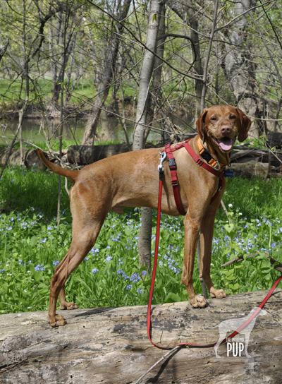
Tavish among the bluebells on the Ford Loop Trail, Monocacy National Battlefield

Because of the three sites’ relatively close proximity to one another, tracing the full story of Monocacy—from the initial battle in Frederick, Maryland, to the conclusion at the tiny cemetery in Washington—is easy to experience in one very full day or over the course of two  leisurely days. There’s the most ground to cover at Monocacy National Battlefield. Begin your foray at the visitors’ center on Urbana Pike. It used to be in smaller quarters at the Gambrill Mill site but moved to this nice new building about five years ago. Although dogs aren’t allowed inside the visitor center, make sure you head upstairs. There’s a succinct yet exceptionally comprehensive exhibition with an overhead timeline, lighted battle map, and several interactives that really help put what you’re about to see outside in a broader context. Be sure to pick up a brochure from the ranger, because it contains not only driving directions but also a trail map. There are 5 separate locations within the national park to get out explore with your dog. As always, dogs are to be leashed and picked up after:

  • While Best Farm and Monocacy Junction don’t have any trailheads per se, there’s plenty of room to explore the immediate vicinities from the parking areas. Best Farm is also associated with a remarkable 1862 event related to Antietam (Learn more at the visitors’ center or Google “Lee’s Lost Orders”!).
  • During the battle, the Gambrill Mill site was co-opted as a Union field hospital, and the short loop trail here includes a boardwalk section leading to the Monocacy River. Tavish enjoyed wading in the shallows.
  • The Thomas Farm site contains two loop trails that wind through the farm fields that withstood the heaviest fighting that day in 1864.
  • Worthington Farm has the longest trails, though neither of the two loops takes more than a half hour to hike. We went on a Sunday afternoon and had the place mostly to ourselves save for a couple joggers. The Ford Loop Trail is flat and hugs the flood plain of the Monocacy River. Should you happen to time it right in the springtime, as we did by happy coincidence, you’ll find the path to be spectacularly carpeted with Virginia bluebells (see photo). Much of the Brooks Hill Loop Trail borders the aforementioned cow pasture. Fresh from his fence episode, Tavish curiously appraised the gangly calves and their moms from a respectful distance. Once the trail enters woodland it quickly gains elevation, topping out on a ridge with an expansive view across emerald farmland toward Thomas Farm.

Back in the District of Columbia, visiting Fort Stevens simply involves snagging a parking spot on the street or in the neighboring church parking lot. All that remains of the once extensive Civil War Defenses of Washington are more than 20 locations throughout DC-MD-VA ranging from simple forest sites to earthworks to full-fledged forts. Fort Stevens is not staffed but does have a couple interpretive panels to orient visitors to the partial reconstruction. Continue the short distance to conclude your journey by parallel parking on Georgia Avenue in front of Battleground National Cemetery.