Intrepid Pup

National Howl-iday Scene: Part III

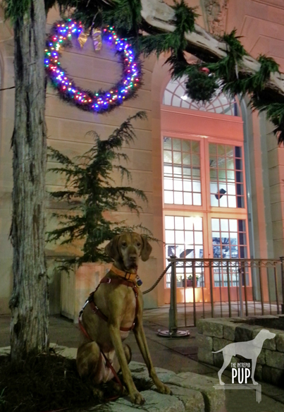
Tavish at the LDS Temple's Festival of Lights

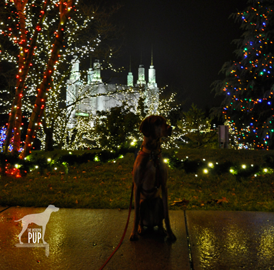
Even raindrops can’t keep Tavish from basking in the glow of 600,000 lights at the Washington D.C. Temple.


Tavish the Intrepid Pup
continues on the howl-iday trail throughout the greater Washington metro area.  Stops so far have included the Capitol Christmas Tree and the  U. S. Botanic Garden’s “Season’s Greenings.”  Next on his itinerary:  the annual Festival of Lights at The Church of Jesus Christ of Latter-day Saints.

The site is a study in juxtapositions. Called the Washington D.C. Temple, it’s actually physically located in Kensington, Maryland. The maelstrom that is the Capital Beltway is just a stone’s throw away with more than 250,000 vehicles a day passing in the Temple’s shadow. And yet the Temple sits upon 52 beautifully wooded acres—in the midst of a residential neighborhood, really. The glistening facade of white Alabama marble looks like nothing else in the area, but it still manages to blend in harmoniously.

When it opened in 1974 it was only the 16th operating Temple; today there are  more than 140. Six spires rise to 288 feet, making this Temple the Church’s tallest. While the adjacent Visitors’ Center is free and open year-round, visitation soars during the annual Festival of Lights celebration.

Click to see what a "1" on the Wag-a-meter meansDogging the Details

39°0′56.07″N, 77°3′56.21″W
Festival of Lights, Washington D.C. Temple – The Church of Jesus Christ of Latter-day Saints, Kensington, Maryland

The 35th Annual Festival of Lights runs  from November 30, 2012 through January 1, 2013 with the lights coming on at dusk. Free concerts are offered nightly in the Visitors’ Center at 7pm and again at 8pm, with tickets available 90 minutes prior to each performance.
Tavish at the LDS Temple's Festival of Lights

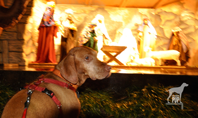
Tavish gazes upon the life-sized crèche outside the Washington D.C. Temple Visitors’ Center.

Team Tavish had the misfortune of timing this visit with a torrential downpour, so we didn’t stay nearly as long as we would have liked. The up-side to the weather, however, was that all 600,000 lights looked extra-spectacular reflecting off the drenched pavement.  Tavish wasn’t too keen about getting rained upon but kept still long enough for a few photos as we gawked at the lights and stopped at the life-sized crèche.

Admission to the grounds is free. Non-Mormons are not permitted in the Temple itself, but all (well, excluding dogs) are welcome in the Visitors’ Center. When we arrived, crowds of people were streaming in to hear the first concert of the evening and see the displays of decorated Christmas trees and more than 100 nativity scenes from around the world. Had the Intrepid Pup not been with us, we would have ventured in as well!

The Festival of Lights earns a “1″ on the Intrepid Pup’s wag-a-meter for illuminating the joys of the season!


Save

Save

National Howl-iday Scene: Part II

Tavish with the holiday lights at the US Botanic Garden

“Season’s Greenings” from the U.S. Botanic Garden! The colorful holiday lights outside merely hint at the wonders that lie within.

Throughout this series, Tavish the Intrepid Pup has been providing an insider’s guide to the national “howl-iday” scene. In his quest to find the most iconic—and dog-friendly—holiday spots the capital region has to offer, Tavish’s “pick of the day” is the annual Season’s Greenings display at the United States Botanic Garden. The institution falls under the auspices of the Architect of the Capitol. Dating to 1850, it has been in its present location on the wedge of land between Maryland Avenue and First Street, S.W., since 1933.

Okay, let’s just start by saying this place is beautiful year-round and is especially so during the holidays. In a city chock-a-block full of monumental and famous structures, it’d be easy to lose this one in the mix. But to do so would be a big mistake. The Botanic Garden takes the lead on horticultural education and issues of sustainable landscape design. With elaborate outdoor terraces and indoor habitats ranging from desert succulents to exotic orchids, there’s something for everyone. Not too be missed is the unique perspective from atop the canopy walk in the tropical rainforest that grows within conservatory’s 93-foot dome. And be sure to check out the magnificent Bartholdi Fountain set upon two acres of rose gardens just across Independence Avenue.

Tavish under the kissing ball at the US Botanic Garden

Will sit for kisses: Tavish has strategically planted himself beneath the mistletoe on the northeast terrace.

Click to see what a "1" on the Wag-a-meter meansDogging the Details

38°53′17.90″N, 77°0′45.46″W
United States Botanic Garden’s “Season’s Greenings”, Washington, DC

Season’s Greenings is on display from late November through early January; check website for exact dates. Admission is free.

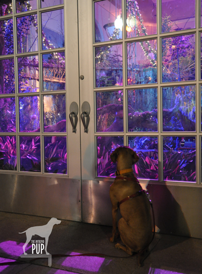
Pups aren’t allowed inside the Botanic Garden’s buildings, but fortunately you can lap up pretty good views of Season’s Greenings by peering through the conservatory’s picture windows after dark. One glimpse of the Enchanted Forest in the east gallery is enough to make you want to return on your own to explore inside.

Tavish looking at the train display at the US Botanic Garden

Tavish gazes longingly into the “Enchanted Forest,” just one part of the Season’s Greenings display. Model trains, decorated trees, and fairytale lighting make this a feast for the senses.

Planning for Season’s Greenings takes nearly a year, with the Enchanted Forest alone requiring approximately three weeks to install. It shows in the details. A carpet of poinsettias in 17 varieties. A towering 24-foot tree—one of the largest indoor decorated trees in the region. Eight hundred feet of track for the model railway. A line-up of live music on select evenings. And a mind-boggling assortment of DC landmarks created in miniature and entirely from natural plant materials!

Parking out in front of the Botanic Garden or at meters off Independence Avenue shouldn’t prove too difficult after hours. What’s more, it’s a “two-fer”: soak in the splendor of the lighted gardens and then make the three-minute  stroll across the street to take in the Christmas tree on the west lawn of the U. S. Capitol (read the Intrepid Pup’s earlier account here).

A trip to the grounds of the Botanic Gardens earns a “1″ on the Intrepid Pup’s wag-a-meter as a free and pretty spectacular photo opp for you and your intrepid pup!

National Howl-iday Scene: Part I

Tavish with the 2012 Capitol tree


GO FIGURE:  Intrepid Pup particularly liked the theme for the 2012 Capitol tree: “The Great Outdoors”! Culled from the White River National Forest in Colorado, this 74-year-old Engelmann spruce made stops in 30 different towns en route to Washington, DC. The tour was sponsored in part by Choose Outdoors, an organization dedicated to connecting Americans to public lands through outdoor recreation. The tree stands 73 feet tall and is laden with approximately 3,000 ornaments, most of which were handmade by Colorado schoolchildren.

With the holiday season comes an explosion of colorful decorations. Elaborate displays crop up in downtowns across America, and for a few short weeks everything takes on the magical luster that only twinkle lights can impart. The Washington, DC metro area is particularly picturesque in December, and the weather is usually still temperate enough that touring around is not a completely frigid proposition.

Over the next several posts, Tavish the Intrepid Pup will give you an insider’s tour of the national “howl-iday” scene, scoping out what are arguably among the most iconic—and dog-friendly—holiday spots the capital region has to offer.

*  *  *

Tavish’s first destination is the 2012 Christmas Tree on the grounds of the United States Capitol.

The original Capitol Christmas tree was a Douglas fir specifically planted on the property in 1964 to fulfill that role. When it eventually succumbed to storm damage, the Architect of the Capitol enlisted the help of the U.S. Department of Agriculture’s Forest Service to sustain the holiday tradition. Every year since 1970, the trees destined for Capitol Hill have been cut and harvested from various national forests. Citizens from the home state supply thousands of handcrafted ornaments showcasing aspects of their state’s heritage, earning the Capitol tree the apt designation as the “People’s Tree.”

Click to see what a 3 on the Wag-A-Meter meansDogging the Details

38°53′23.24″N, 77°0′40.19″W
United States Capitol Christmas Tree, Washington, DC

The 2012 tree is on view December 4 – 26, 2012.

While the Capitol tree is one of Team Tavish‘s favorites in the metro DC region, it’s also the most fleeting. The cut tree arrives shortly after Thanksgiving and takes a little more than a week to be secured and decorated before a public tree-lighting ceremony with the Architect of the Capitol and the Speaker of the House in early December.  Thereafter, the tree is illuminated nightly from dusk to 11 pm until shortly after Christmas.

Timed parking on the street and in nearby surface lots makes the Capitol tree readily accessible during the evening hours. The large West Lawn can accommodate a LOT of people before ever seeming crowded, and that truly distinguishes this setting from some of the others on the “howl-iday scene.”  You can get right up close to the tree without being rushed or jostled, and that makes it great for checking out the diversity and creativity of the decorations. This year’s tree is an Engelmann spruce from Colorado, so many of the ornaments depict Colorado wildlife, mining and skiing-related imagery, and symbols from Native American tribes.

On the evening of our visit, construction related to President Obama’s upcoming second inaugural was well underway on the Capitol portico and lawn. . . perhaps explaining why this year’s tree will only be on view through December 26. The 7,000 LED bulbs produce a riot of color, with the luminous dome of the Capitol providing a signature backdrop for photographs.

Tavish was the only dog in sight when we arrived, although a couple more arrived as we were leaving.  Tavish seemed more than content to pose with the tree and sniff at the low-hanging boughs. Remember to keep your dog on-leash (the area is patrolled by Capitol Police) and bring bags to clean up; trash receptacles are located by the gateways on First Street, S.W.

The comparative lack of crowds makes this outing a pleasant one for dogs and humans alike. Combine that with the ability to capture some great holiday photos at a truly unique venue, and this excursion gets a “3” on the Intrepid Pup’s wag-a-meter.

Out & About in Vacationland: Part II

Earlier this year Team Tavish wrote about the first Great Maine Outdoor Weekend (GMOW), a new bi-annual event that promotes physical activity and encourages folks to revel in all that’s great about Maine’s natural resources. September 28-30, 2012, marked the second GMOW, and with it, Tavish the Intrepid Pup promised to offer “Part II,” revealing three more stunning destinations in Vacationland. He enjoyed frequenting these places in the 5½ years he lived there, so he’s pretty confident that you and your dog will enjoy them too. So, without further ado…

Dogging the Details

wag-a-meter set at 2

Though in three separate regions of Maine, the excursions described below all rank “2” on the Wag-a-meter as being active, outdoor adventures requiring a little bit of planning. As always, be sure to bring along water for your dog, a snack, and some doggie bags.


MAINE LAKES AND MOUNTAINS

44°56′08.58″ N, 70°32′13.24″ W
Rangeley Lakes, Maine

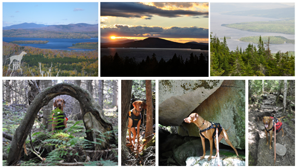
Montage of Rangeley Lakes

Rangeley. The region is virtually synonymous with northern New England, and place names like Mooselookmeguntic and Height of Land simply reinforce its remote and wild allure. It’s the backdrop for Maine’s logging history. The playground for countless generations of sportsmen. The muse of the legendary Carrie Stevens (1882-1970) and her streamer fly. The setting for author Louise Dickinson Rich’s (1903-1991) best sellers, and the thirty-year summer retreat of iconic photographer William Wegman and his famous dogs.

To enter Rangeley is to embrace Maine’s great outdoors. Team Tavish and the Intrepid Pup  have twice stayed at Town & Lake Motel and Cottages; once in late May and again in October. Located on the shore of Rangeley Lake, next to where the sea planes dock, the motel is pet-friendly and a more than adequate home base from which to explore the area. In-room reading is a binder chock full of historical ice out dates, leaving no mistake that this is definitely a place for hard core snowmobilers and ice fishermen.

While Rangeley rightly promotes itself as a four-season wonderland, summer and fall are really the best times for visiting with your dog. Come prepared for great hiking, amazing scenery…and the near certainty of seeing moose.  But be equally prepared for black flies, cool nights, and rapidly changeable weather. Tavish made good use of his Ruffwear™ pack to carry extra food and water for the day. Wearing blaze orange was a must during our autumn hikes as hunting season was in full effect. (Click here to see some of his gear).

The Rangeley Lakes National Scenic Byway is a 35-mile ribbon incorporating sections of Routes 16 and 17. It’s also the access corridor to a number of trail heads of varying lengths and degrees of difficulty.  Tavish-approved highlights include:

  • The short 0.5 mile trail at the 2000-foot Cascade Stream Gorge, with views of 16-foot waterfalls and deep pools.
  • The roadside turnoff at Smalls Falls, with a walkway to see the 54-foot falls.
  • A 1.75 mile trail to the summit of Bald Mountain (2443 feet), with its 30-foot lookout tower.
  • The Appalachian Trail, with a 1.4 mile section to the impressive Piazza Rock.
  • Miles of trails on the 4120-foot Saddleback Mountain. This ski resort permits hikers on base area trails and ski runs during the off season. The chair lifts aren’t operational in the summer, but parts of the main lodge remain open. With wide open spaces, lots of birds to watch, and plenty of evidence of deer and moose, this was probably Tavish’s favorite to explore.


GREATER PORTLAND AND CASCO BAY

43°49′14.47″ N, 70°04′54.05″ W
Wolfe’s Neck Woods State Park, Freeport, Maine

Montage of Wolfe's Neck

Even if you’re otherwise unfamiliar with Maine, you’ve likely heard of Freeport, thanks to it being the venerated home of  outdoor outfitter L.L. Bean. The  flagship store is so touted as a Maine destination that you pretty much have to stop by. While you’re there, sneak a peek at the store’s doors. They’re notable for what’s missing, namely locks.  Since the facility is open 24 hours a day/365 days a year, there’s simply no need for them. That’s what we call a good dose of Yankee practicality. Seriously, check it out…and be sure to snap a photo out front with the 16-foot replica of the hunting boot that launched the company and secured Leon Leonwood Bean’s legacy in the annals of retail history. While your dog can’t accompany you in the store, there’s plenty of dog gear (hunting and otherwise) to be found inside. And you and your dog can always chill in Discovery Park; in the middle of the L.L. Bean retail campus, this compact greenspace doubles as an expo area during Bean’s product demo days and also has a stage on which the company presents its free summer concert series.

But if you can extricate yourself from the constellation of outlet stores downtown, you’ll find that Freeport “beyond the Boot” has a lot to offer in the way of natural splendor. Just a 5-minute drive and you’re quickly away from the 3 million visitors who flock to town each year. Take Bow Street to Flying Point Road, and make Wolfe’s Neck Woods State Park your destination.  L.L. Bean’s Paddling Center is just an inlet away from this easily accessible state park.

While you won’t likely get short of breath walking at Wolfe’s Neck, the views will most certainly take your breath away. Within steps of leaving the parking lot picnic area, the Casco Bay Trail slopes gently to where emerald conifer forest meets azure sea and sky. The stolid outcrops that dot the bay are whimsically called the “Calendar Islands,” because surely there are 365…one for every day of the year! The closest is Googins Island, an osprey sanctuary, and every time we’ve visited during the summer we’ve seen nesting osprey. The trail skirts a pebbly coastline before linking up to the Harraseckett and Hemlock Ridge trails to form about a mile-long loop returning you to the parking lot. Do note that there are no receptacles along the trail, so bag any waste for disposal back at the picnic area.

MAINE BEACHES

43°14′42.43″ N,  70°35′31.14″ W
Marginal Way
, Ogunquit, Maine

43°13′24.49″N,  70°41′30.11″W
Mount Agamenticus,York, Maine

Montage of Ogunquit

Not far after crossing Maine’s southernmost border you reach Ogunquit, a town whose apt Chamber-of-Commerce-tagline is “Beautiful Place by the Sea.” Park anywhere you can. Be forewarned that this is a particularly challenging task during the summer months, though a good place to try first is the pay lot just down Shore Road on Cottage Street. If you’re successful in finding a spot in the upper part of town (near the intersection of Route 1 and Shore Road), walk along Shore Road until you come to the Sparhawk Oceanfront Resort; a narrow walkway bordered by tennis courts and lush gardens leads to one of the best coastal trails you’ll ever come across: the Marginal Way.

Dogs are not allowed on the Marginal Way between April 1 and September 30 but are welcome on-leash from October 1 through March 31 (and you can take in the October “HarvestFest” and the December “Christmas by the Sea” activities then, too). The Marginal Way traverses Anchorage by the Sea Resort’s sprawling oceanfront before gaining elevation and hugging the rocky coastline for approximately 1 mile. The 39 benches dotting the paved path offer ample opportunity for quiet contemplation and gazing upon the oft-painted vistas of Ogunquit Beach, the Atlantic Ocean, and a small lighthouse. Marginal Way’s terminus is at Oarweed Cove; a narrow spit of land separates it from the compact yet equally picturesque Perkins Cove. Fishing charters depart from the wharf, and visitors flock to photograph the harbor, browse the cluster of art galleries and boutiques, and enjoy lobster rolls and chowder. While you can always retrace your steps—Marginal Way never gets old!—an alternate way back is to walk along Perkins Cove Road and then Shore Road, passing numerous shops en route.

A nearby point of interest is Mount Agamenticus, just 6.5 miles southwest of downtown Ogunquit, in York.  Take Route 1 south a few miles, make a right onto Agamenticus Road, and another right onto Mountain Way. Just when you start to think you’re lost on this curvy back road, you’ll see signs for the Mount Agamenticus summit. Rising only about 700 feet, Agamenticus is clearly no Everest, but its proximity to sea level makes it a prominent fixture on the horizon. The surrounding 10,000 acres are managed as a conservation region, thus preserving vernal pools, a superb vantage point for watching migratory hawks, a unique coastal ecological habitat, and a good bit of history. The first radar tower in the nation was placed atop Agamenticus in the 1940s, and the expansive view of the southern Maine coast made it strategic for spotting submarines and warships during WWII. In later years, wildfires became a greater threat than enemy vessels; the radar tower was supplanted by a fire tower still actively manned today. Agamenticus even enjoyed a brief and more benign stint (1964-73) as a ski resort. The summit lodge remains, and many of today’s multi-use trails (hiking, mountain biking, snowshoeing/cross-country skiing) were once ski runs.

Intrepid Pup loves the ruggedness, summit view, and relative solitude. Like giant calluses on the landscape, the smooth outcroppings of bedrock  on so many of the former ski slopes can prove slick for the two-footed (particularly during spring run-off and mud season), but scrambling over the terrain is what Tavish most enjoys about  a visit to Agamenticus. Choose from among three loop trails that vary in length from 2 to 3.2 miles.  Dogs must remain leashed, and all waste must be packed out, because there are no trash bins onsite.


Apro-Poe of Halloween

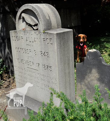
Poe gravesite

A raven marks the spot: Tavish lurks in the shadows behind the monument indicating where Edgar Allan Poe was originally interred.

As the literary master of the dark and dreary, Edgar Allan Poe (1809-1849) and his special brand of Gothic fiction tie in conveniently with the whole Halloween oeuvre. So, on this All Hallows’ Eve, allow Tavish the Intrepid Pup to take you on a virtual visit to Poe’s grave site in Maryland.

Several cities lay legitimate claims to Poe—Boston, New York, Richmond, and Philadelphia among them. Yet, it’s Baltimore where Poe not only lived with relatives in the early 1830s but also where he ultimately died under somewhat mysterious circumstances…turning what was to have been a brief stopover in October 1849 into an eternal one.

At the heart of downtown Baltimore and today encircled by the University of Maryland School of Law are the Westminster Hall Burying Grounds and Catacombs. Despite the name, these catacombs are nowhere near as creepy as the ones that figure in Poe’s own tale, The Cask of Amontillado. The burial grounds date to the late 1700s, and the 1852 church on the site—sans congregation—is now used for private event rentals.

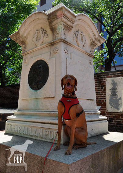
Poe's final resting place

Poe’s final resting place at Westminster Hall Burying Grounds. There’s no Poe Toaster in sight…unless it’s the Intrepid Pup!?!

The cemetery is actually home to not one but two Poe memorials. Proceed to the rear of the cemetery to see Poe’s initial 1849 burial plot.  While this grave never had a marker, you can’t miss the monument eventually placed there in 1913 depicting the haunting raven immortalized in Poe’s 1845 poem by the same name. On the afternoon of our visit it was particularly hot, and Tavish managed to plunk himself down in the only piece of shade, which happened to be right behind the stone and therefore created a bit of a spooky effect (see photo, right).  As the marker’s accompanying inscription indicates, Poe was exhumed in November 1875 to be re-interred in a grave with his mother-in-law/aunt Maria Clemm (1790-1871) located near the cemetery’s entrance. A decade later, the remains of Poe’s young wife/cousin Virginia (1822-1847) were transported from New York and reunited with the others in the family plot. This marble monument (see photo, left) bears all three occupants’ names, as well as a large bas-relief of Poe’s likeness.

More than two centuries later, there’s still a morbid fascination with all things Poe, and perhaps nothing epitomizes this better than the anonymous soul (or souls?) known simply as the “Poe Toaster.” Beginning in 1949 on the anniversary of Poe’s birth—and continuing for 60 years!—a man would visit the monument in the dead of night to leave a half-full bottle of cognac and three red roses.  A no-show on what would’ve been Poe’s 201st birthday heralded the end of this curious tradition, prompting local headlines to proclaim the Poe Toaster “nevermore.”

Dogging the Details

Click to see what a "1" on the Wag-a-meter means39°17′23.25″N,  76°37′23.35″W   Find it on the Intrepid Pup Map >
Westminster Hall Burying Grounds and Catacombs, Baltimore, Maryland

Literary history meets an easy bit of urban exploration to register a “1” on the Intrepid Pup wag-a-meter for this excursion.

The nearest parking garage is a block away at the Baltimore Grand (5 North Paca Street).

Upon arrival, take care in traversing the uneven brick walkways within the cemetery, and respect the grave markers. Westminster Hall offers seasonal, guided tours, but there’s a surprising amount of information to be found on various historical plaques throughout the grounds should you prefer to do a self-guided version. Spoiler alert: Poe is not the only famous historical figure buried here! Among others, look for the grave of James McHenry (1753-1816), the namesake of Baltimore’s Fort McHenry of Star Spangled Banner fame.